Posts filed under Adventure Tuesday

A hike on the East Coast - Franconia Ridge

Adventure Tuesday

Franconia Ridge

Last year we finally did another long hike on the east coast. The previous year we had done a pretty intense hike in the Adirondacks, and we’d been craving another one for quite some time. This time we drove to Woodstock New Hampshire and had planned to hike Franconia Ridge.

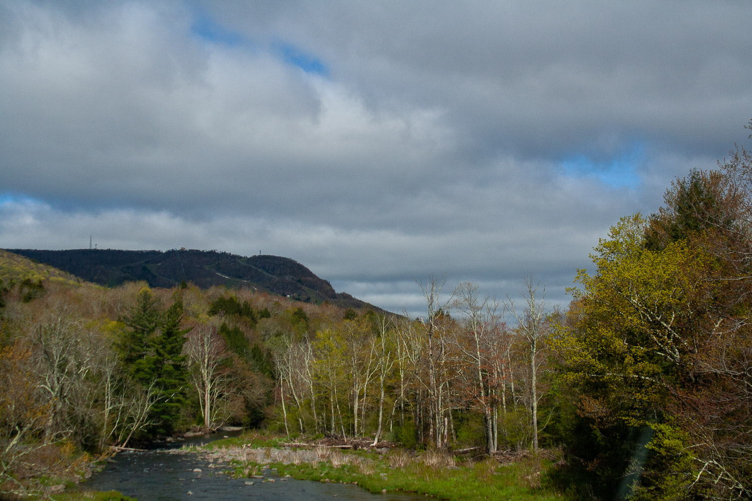
The White Mountains, but in New Hampshire

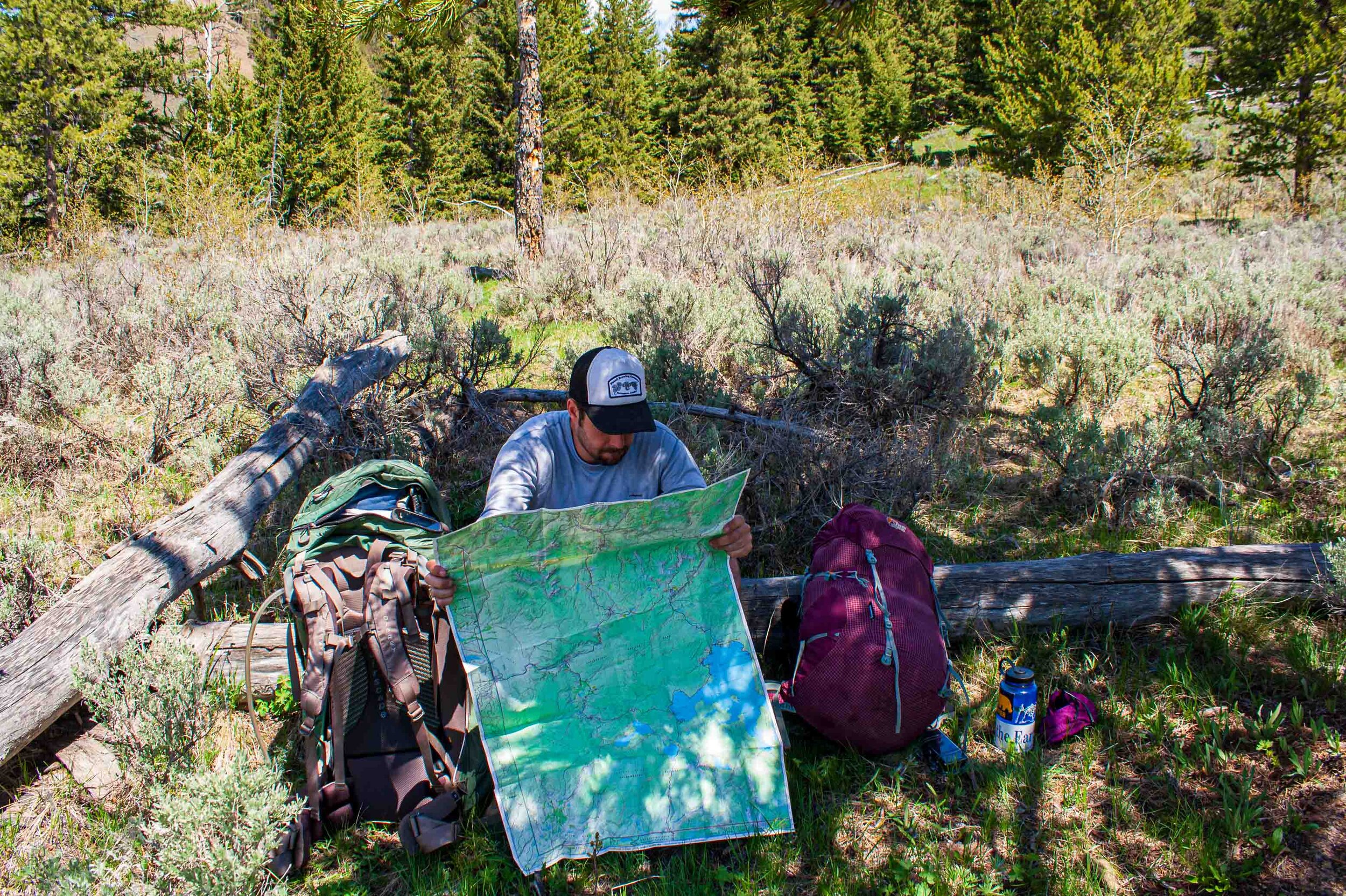
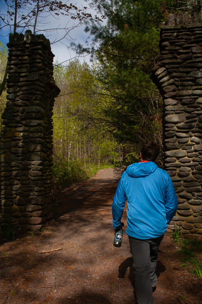
Franconia Ridge is a mountain ridge that belongs to the White Mountains. Not too surprisingly there are more mountains than the Alaskan that has the iconic name of White Mountains. This hike is very popular, and when we arrived at the parking lot some minutes before 9am the parking lot was already full. W dropped me off and he drove to an overflow parking area and took a shuttle bus back to the trailhead.

IMG_4887-September 15, 2019.jpg

Clockwise or counter clockwise?

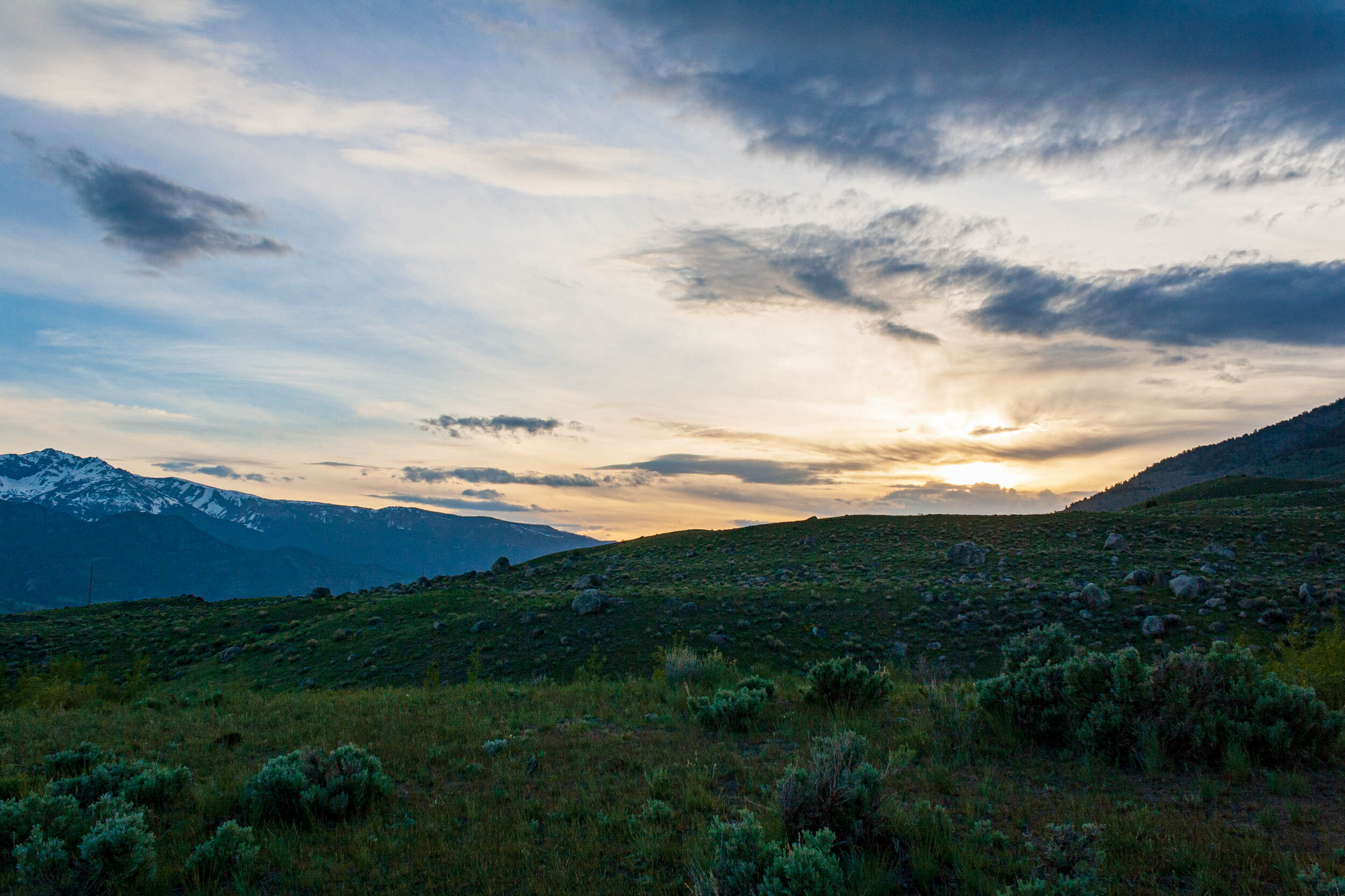
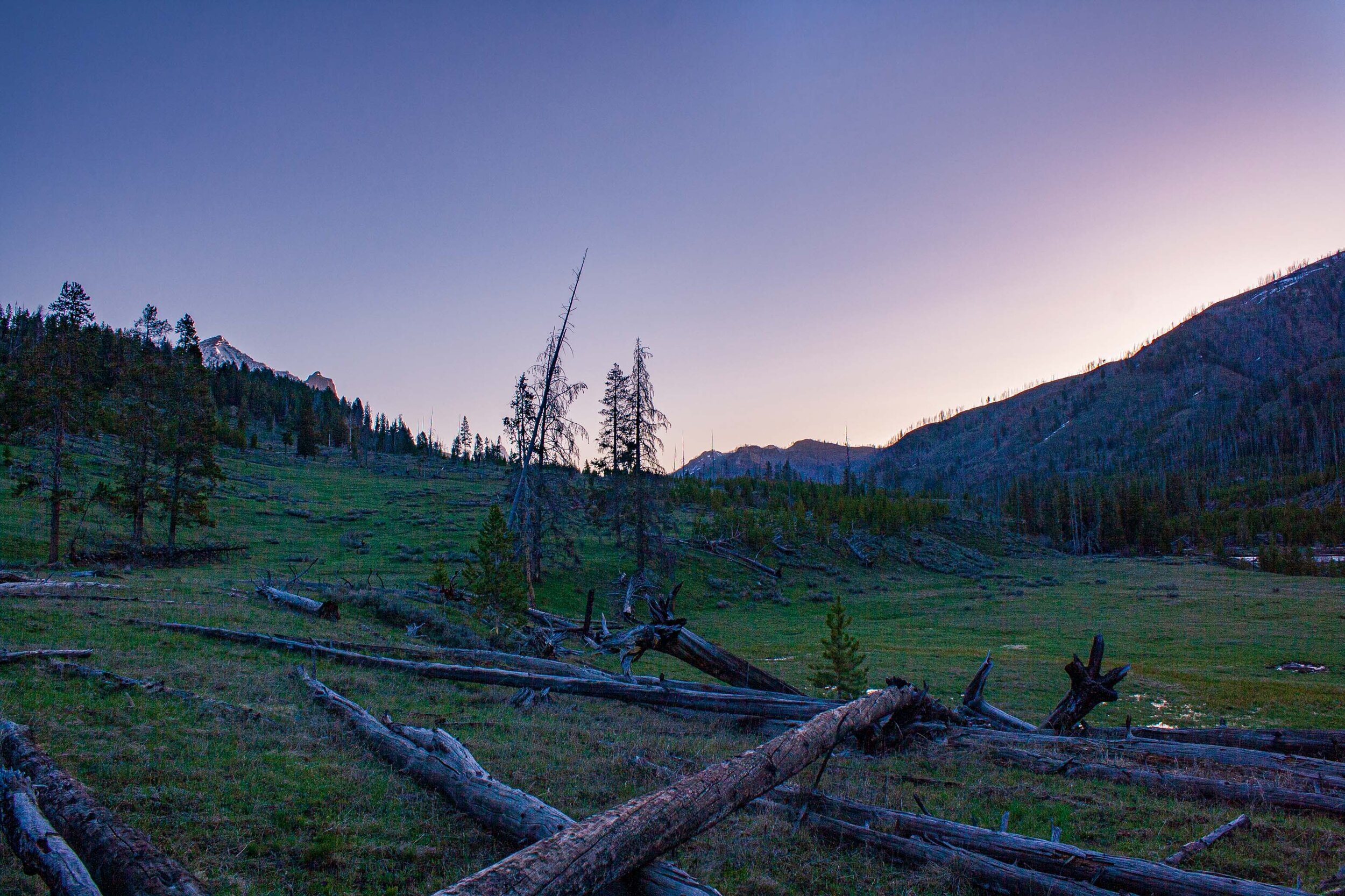
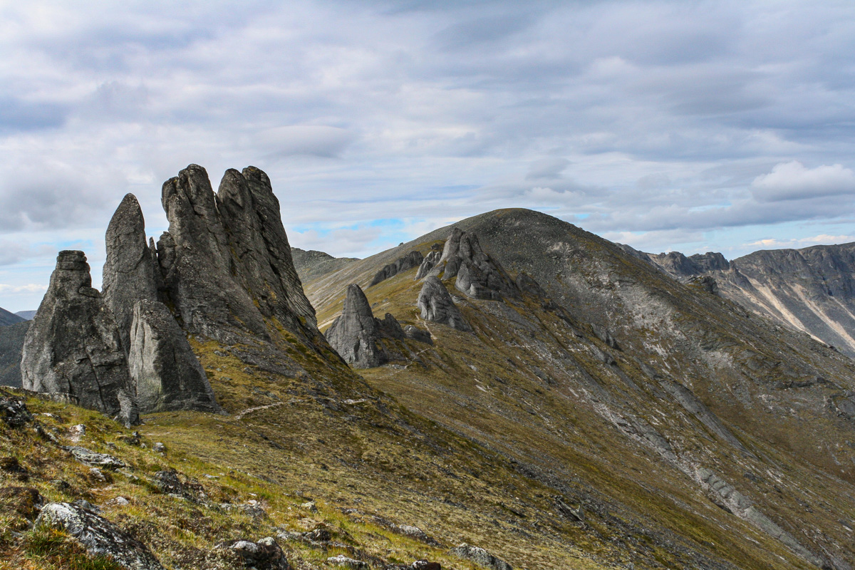
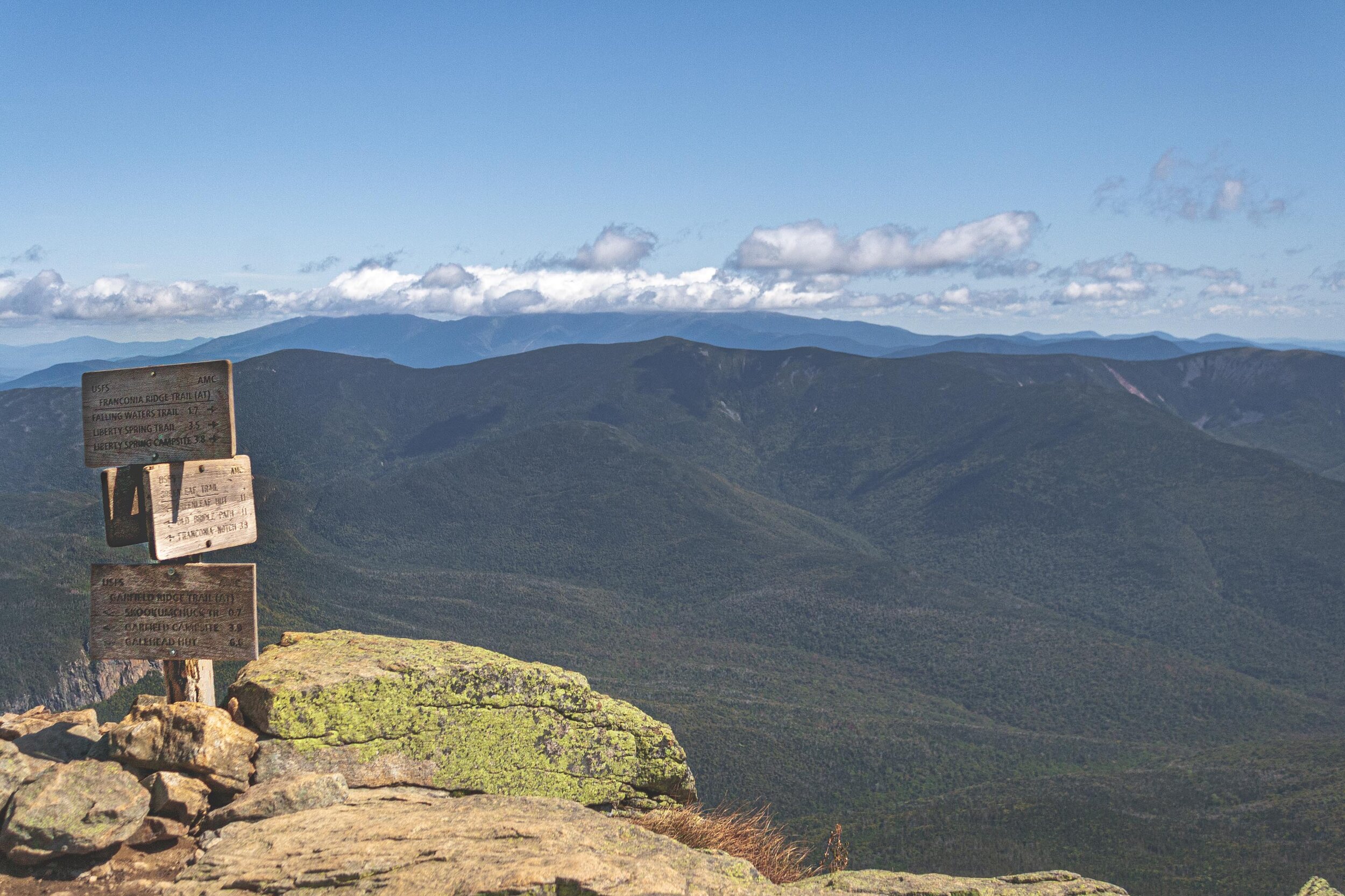
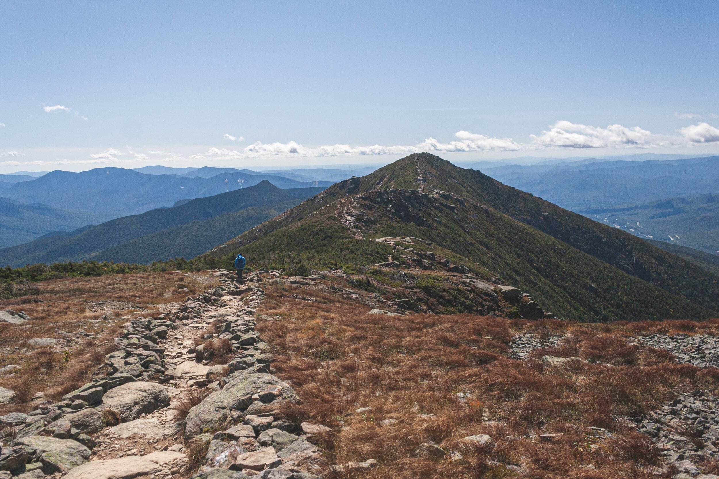
As with many of the other hikes we have done we try to find those that give you magnificent views. We had read reviews about this hike, and I would say that the majority of them recommended to do the hike counter clockwise. But both W and I found information from others that this hike is best done clockwise. Not to surprisingly almost everyone else did the hike counter clockwise, which resulted in quite a few passing along the trail. Apparently there is a hiking book that clearly states that this hike should be done counter clockwise. But as with everything in life there are many different opinions about what is best and how you should do things. After doing the hike we still agree that the best way is to do it clockwise. In this way you get up in elevation pretty quick and descending is more gradual (although others might argue that the descent is hard on your knees, so maybe it depends on the status of those). The hike is rated as hard and it also says that only experienced hikers should do this 8.6 mile and 3,822 feet of elevation gain hike. You’re not only getting one peak, but three peaks during this hike, all above 4,500 feet. Franconia Ridge is part of the Appalachian trail, and maybe that is one of many reasons it is so heavily trafficked.

September 15th, 2019

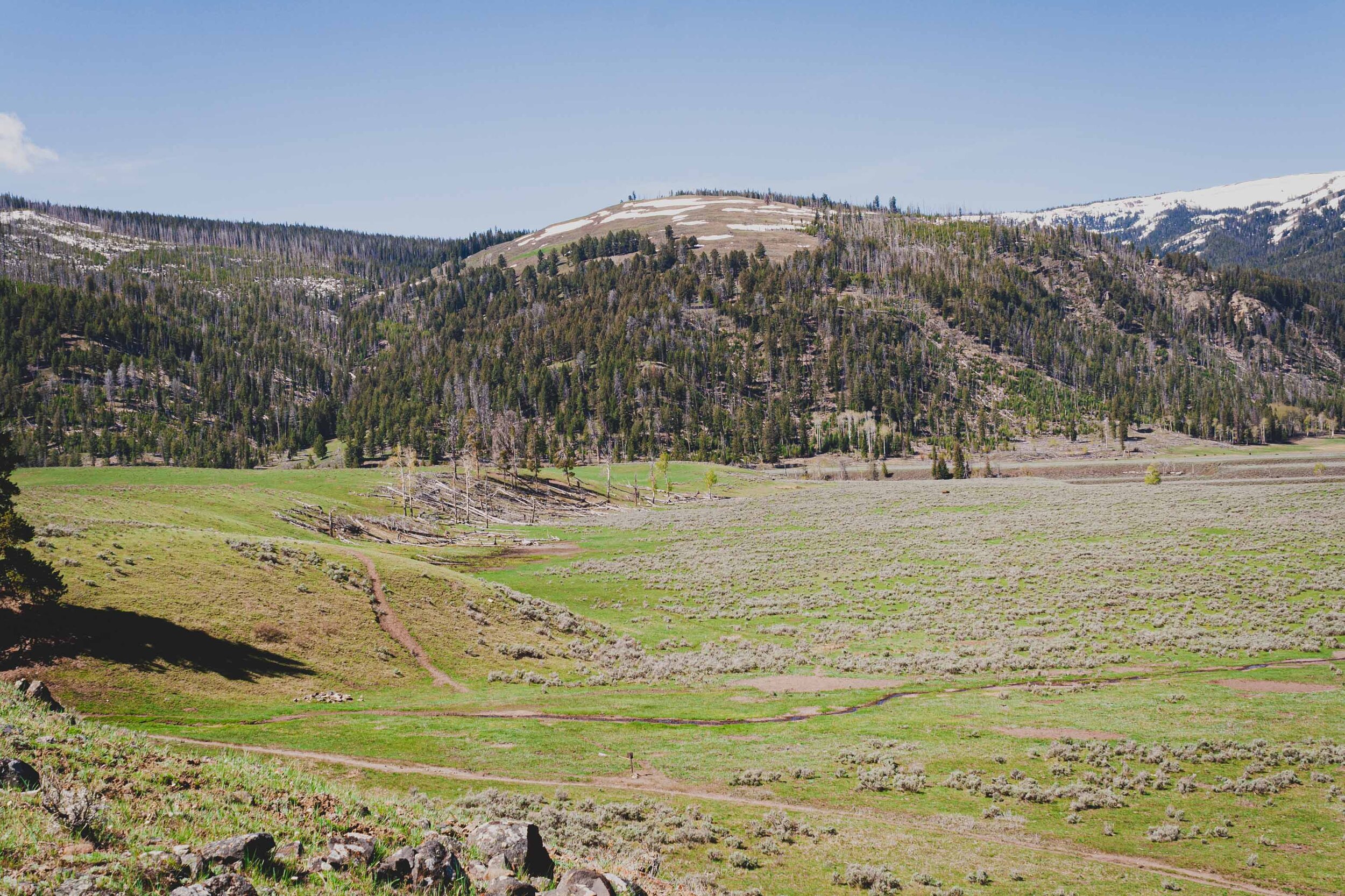
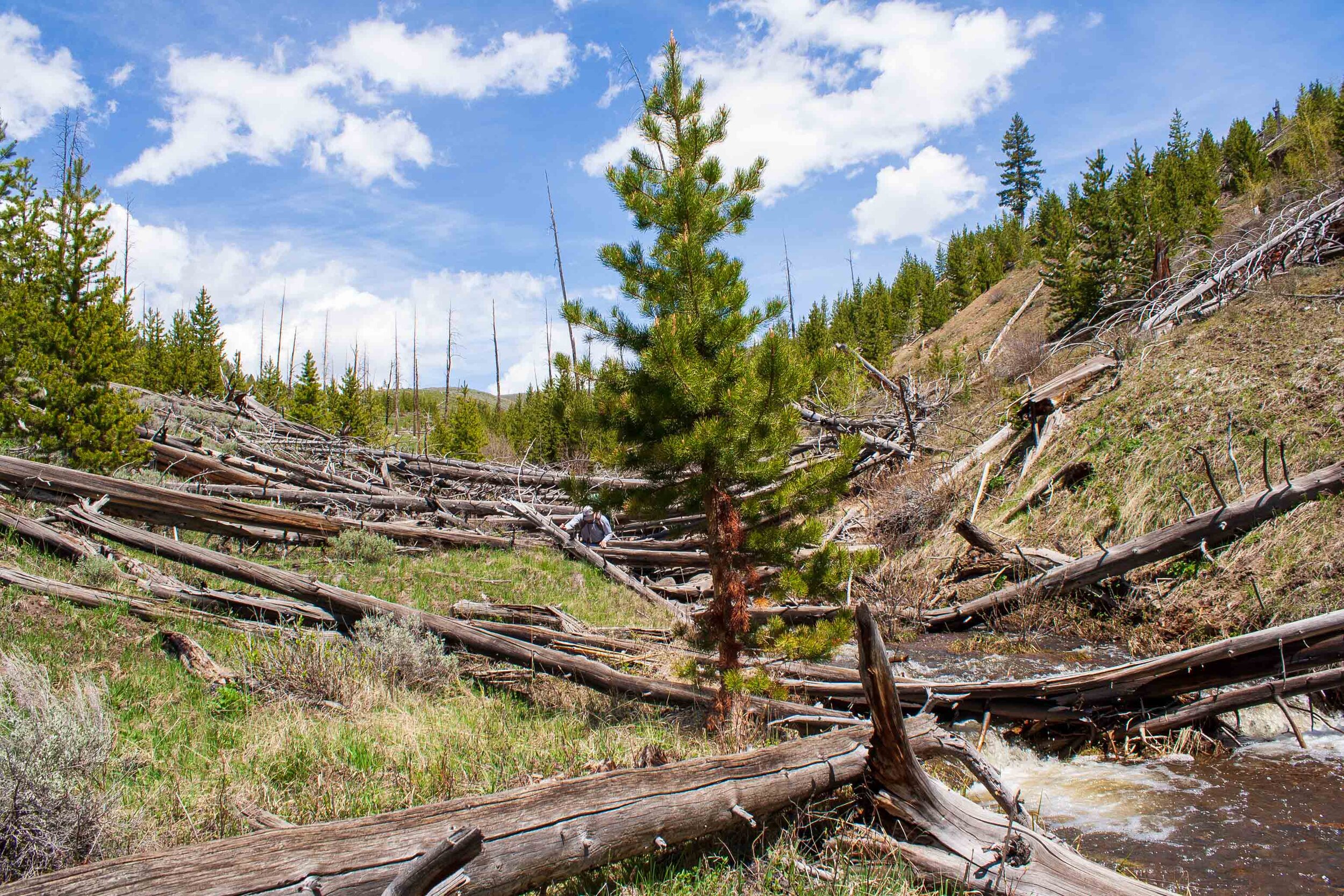
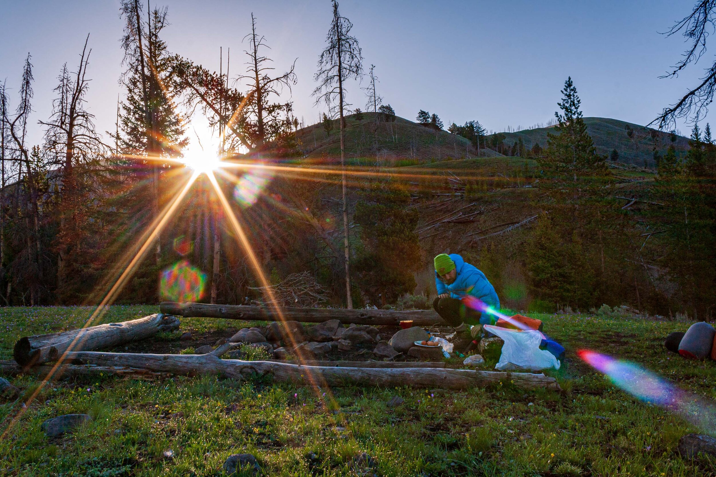
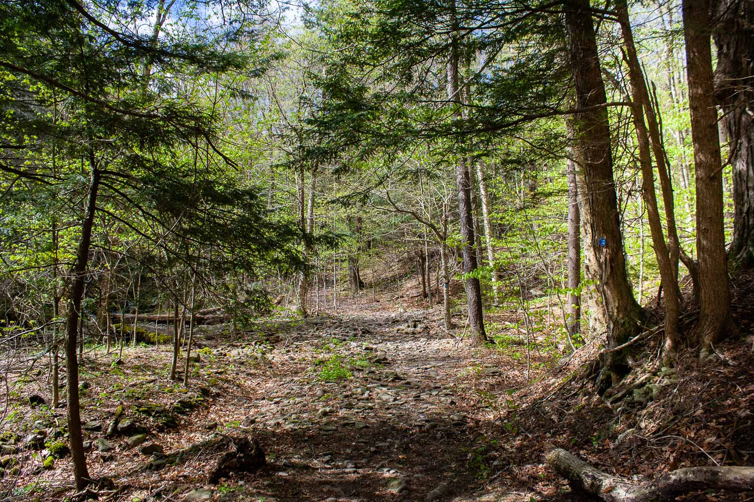
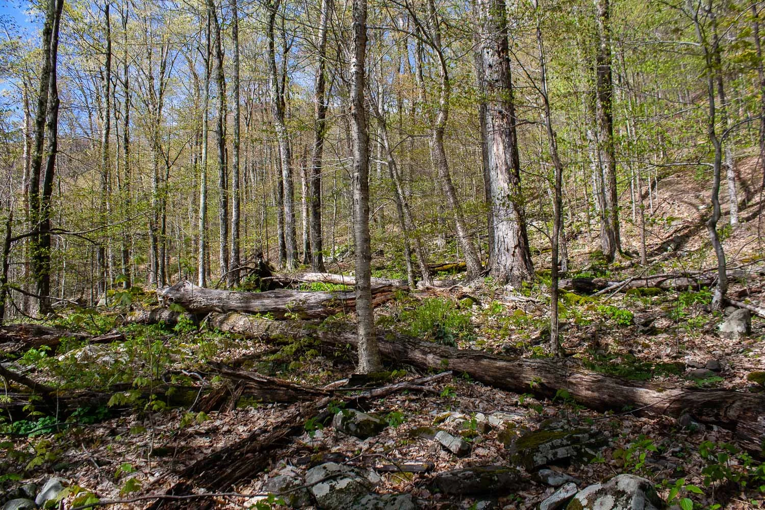
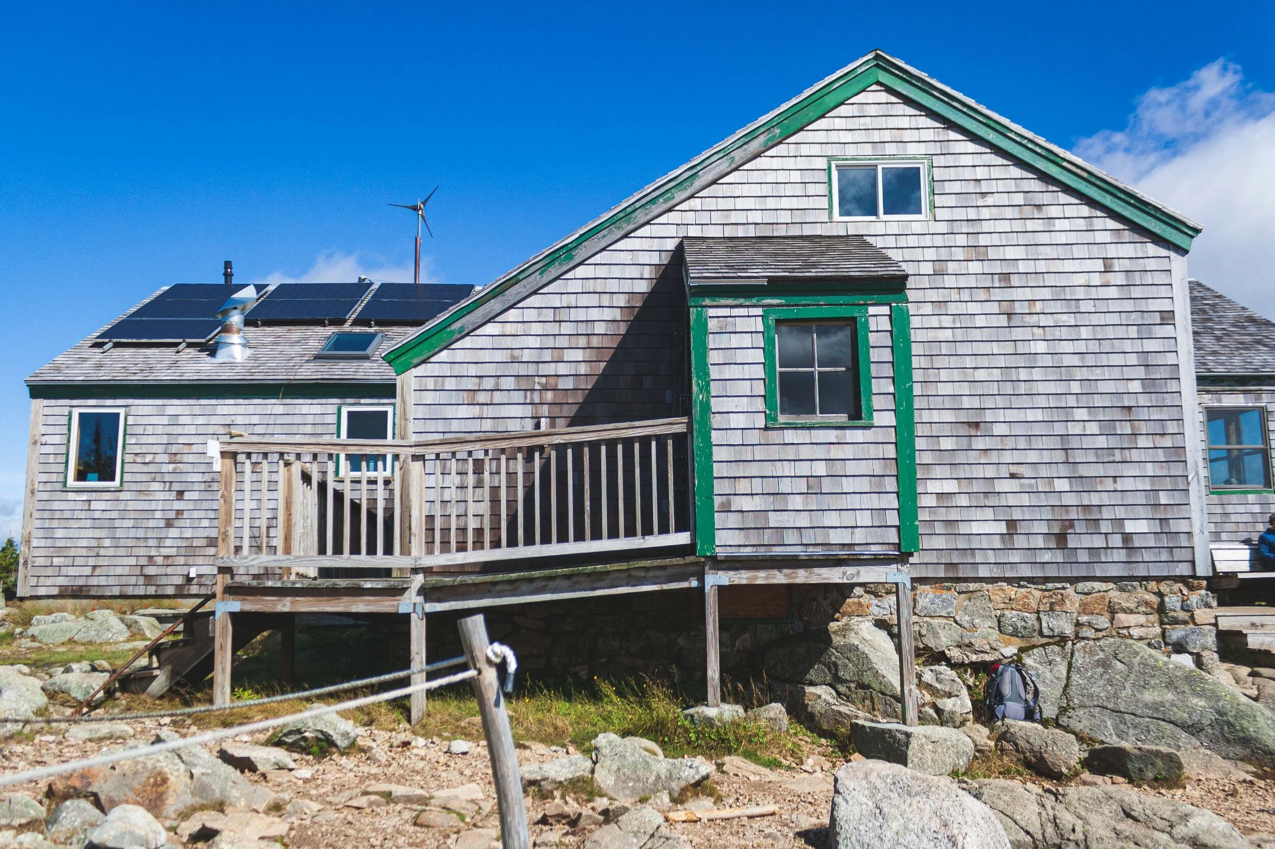
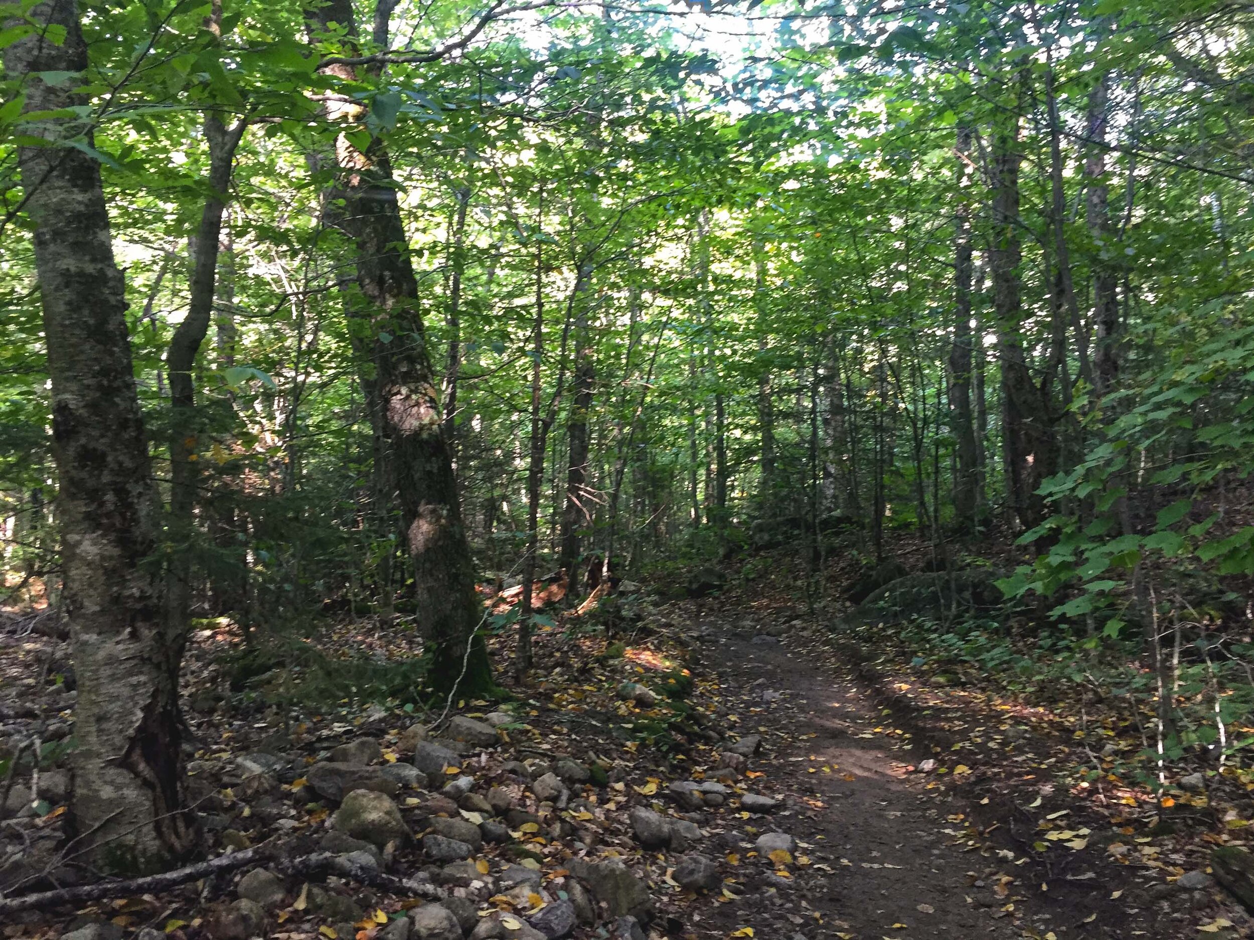
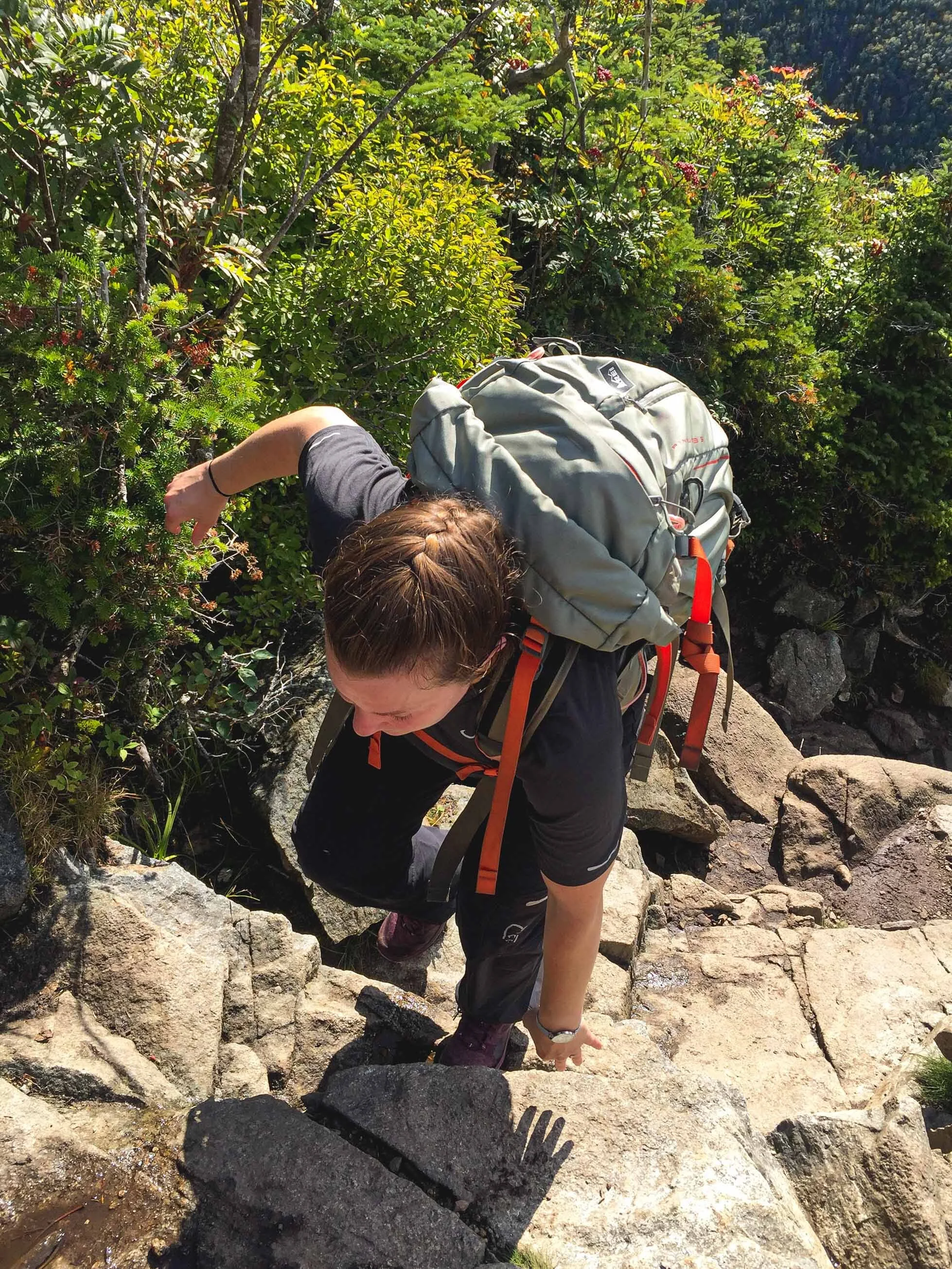
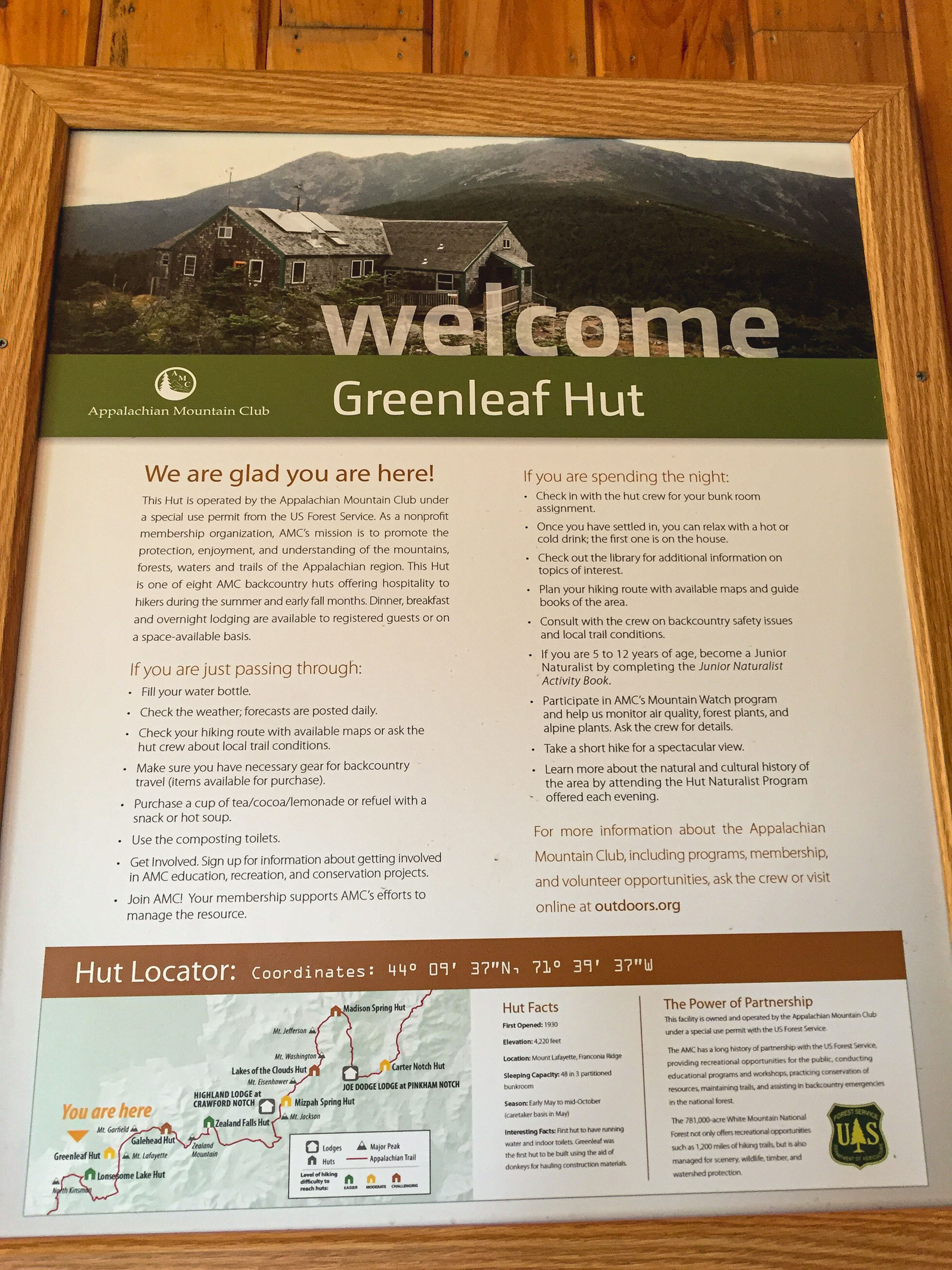
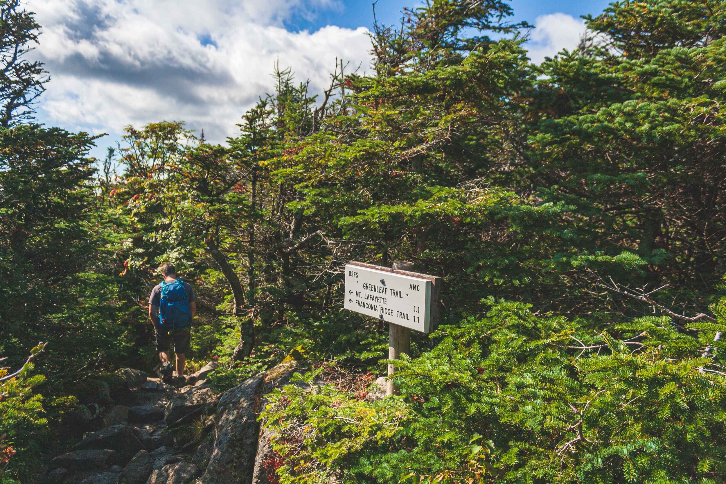
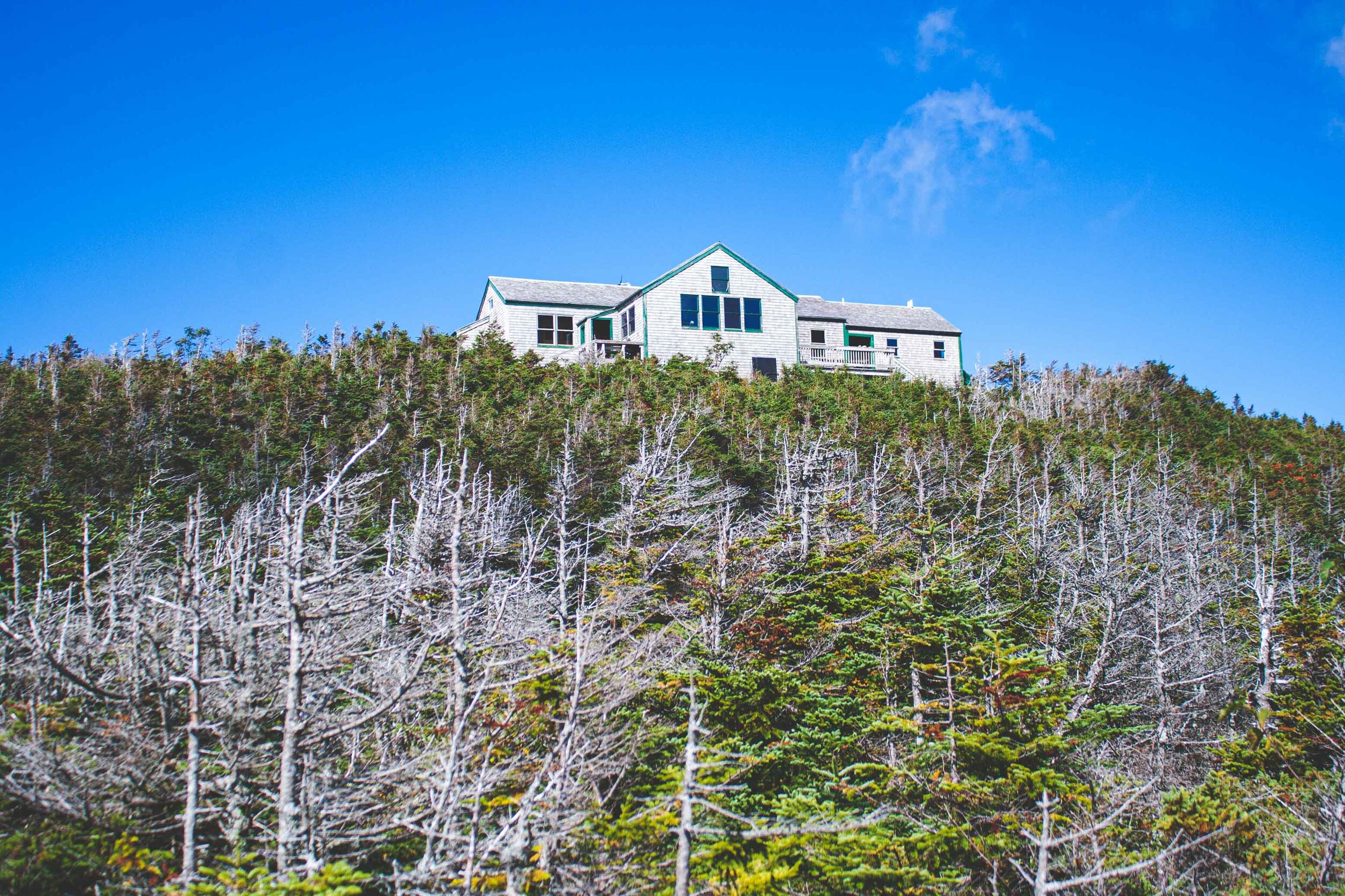
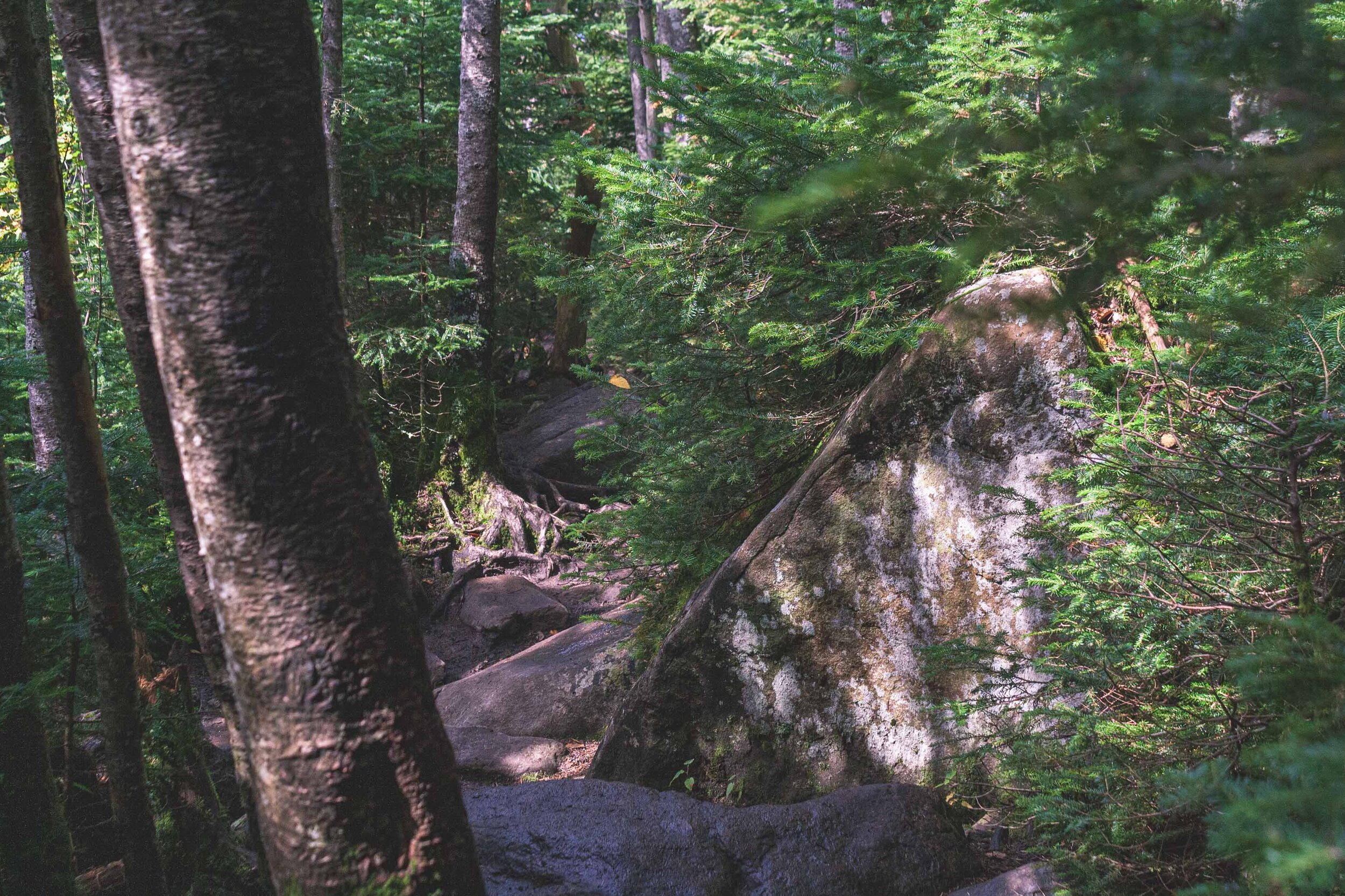
We started the hike and started to ascend one of the peaks almost immediately, which also meant pretty steep conditions. Just like the hike in the Adirondacks we had done the year before, we found ourselves climbing over large boulders for big chunks of the hike. The geology on the east coast is incredible. As with other longer hikes, I had to bite my tongue to not stop all the time to take photos, and I ended up leaving the digital camera in the backpack during many sections of the trail. It’s about 2.6 miles to the AMC hut, and there are quite a few people hiking only to that hut. Here you can get a meal and also spend the night if need be.

Mount Lafayette

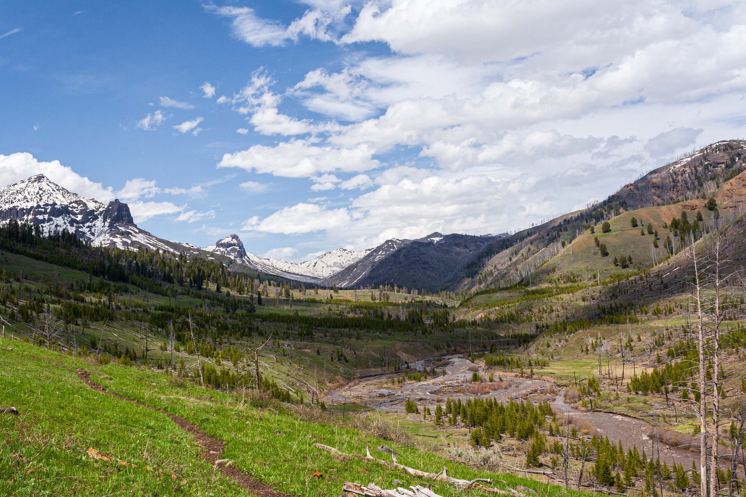
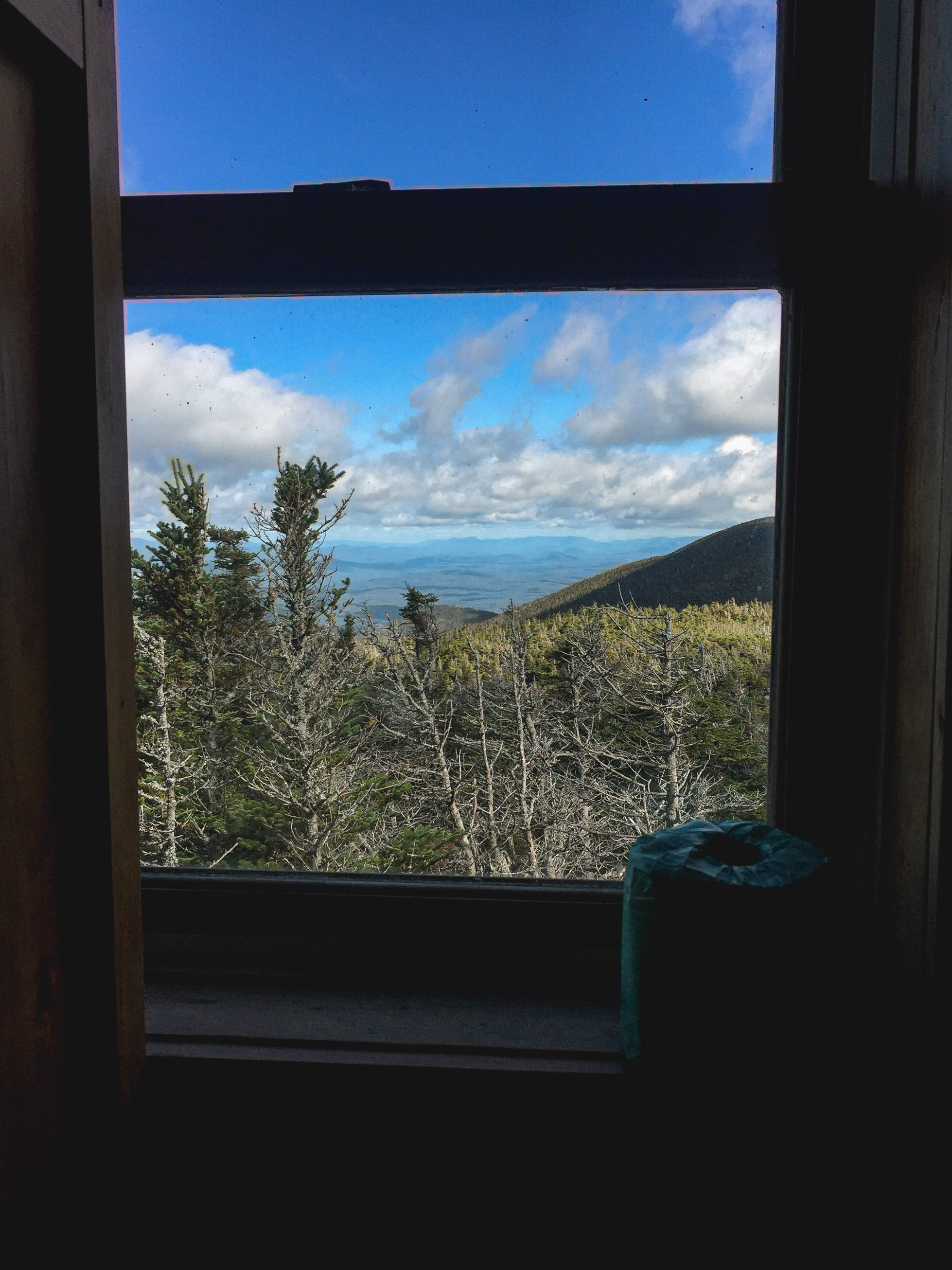
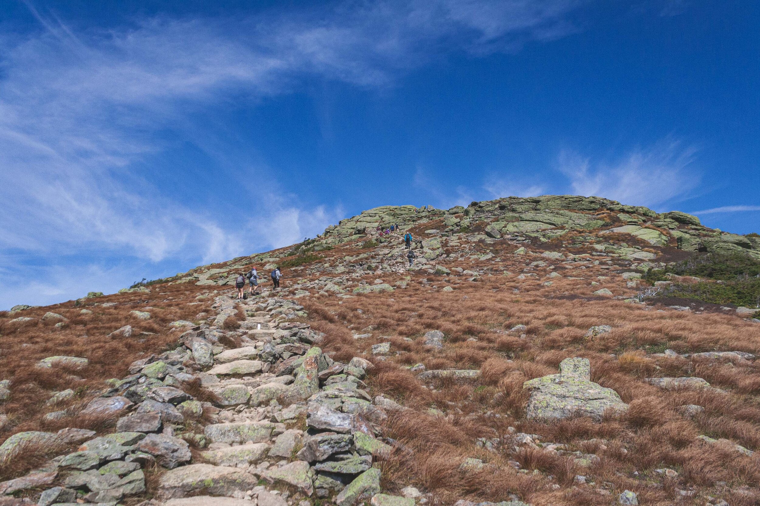
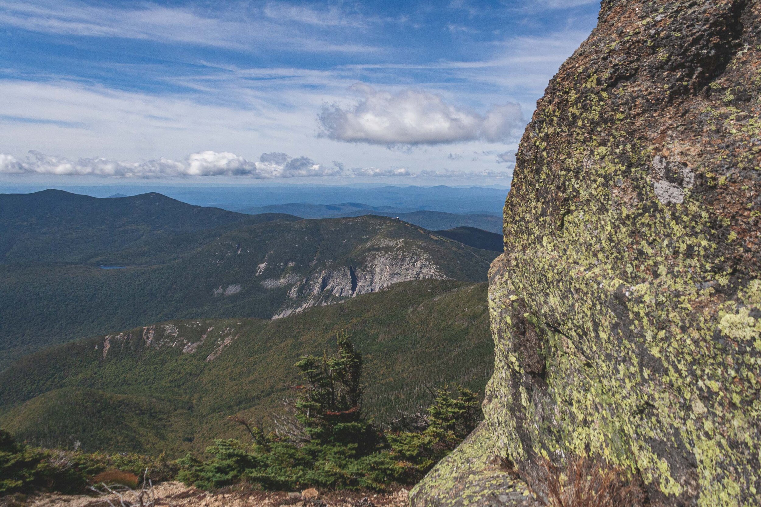
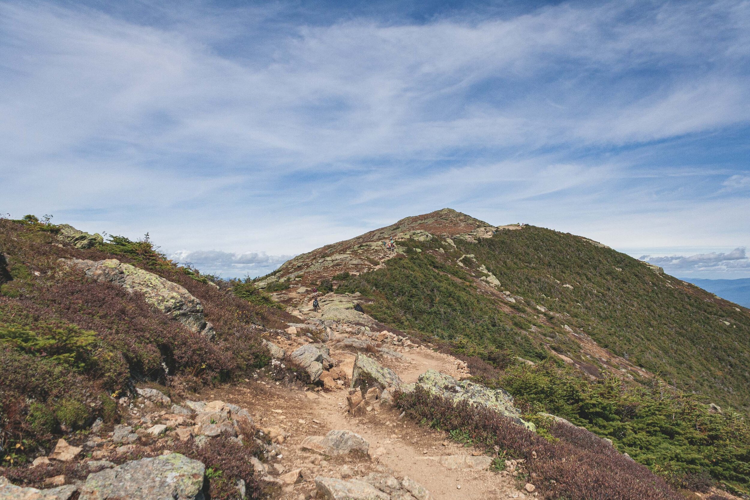
From the AMC hut we quickly continued upwards, towards Mount Lafayette that sits on an incredible 5,242 feet. It’s about 1.1 miles to the peak, but you will also gain about 985 feet during that mile. Once we eventually reached the top of the mountains we had 360 degree views of the White Mountains. We were incredible lucky with the weather and were treated with both a blue sky and warm weather. We had to pass a lot of people of course, since everyone else tend to do the hike counter clockwise, and just like Algonquin Peak in the Adirondacks you are in a very fragile alpine zone up here so it is important to watch were you step, if you have to step off the trail.

Once you’re up on the ridge you don’t really take note of the second and third peak. Or rather there isn’t a big sensation about reaching those peaks since you already done the tallest of the three. Just like the trail reviews and description says there were a lot of people up on the ridge. I don’t think I have ever seen that many people on a hike before. My photos might not show it, but believe me, there were a lot of people here.

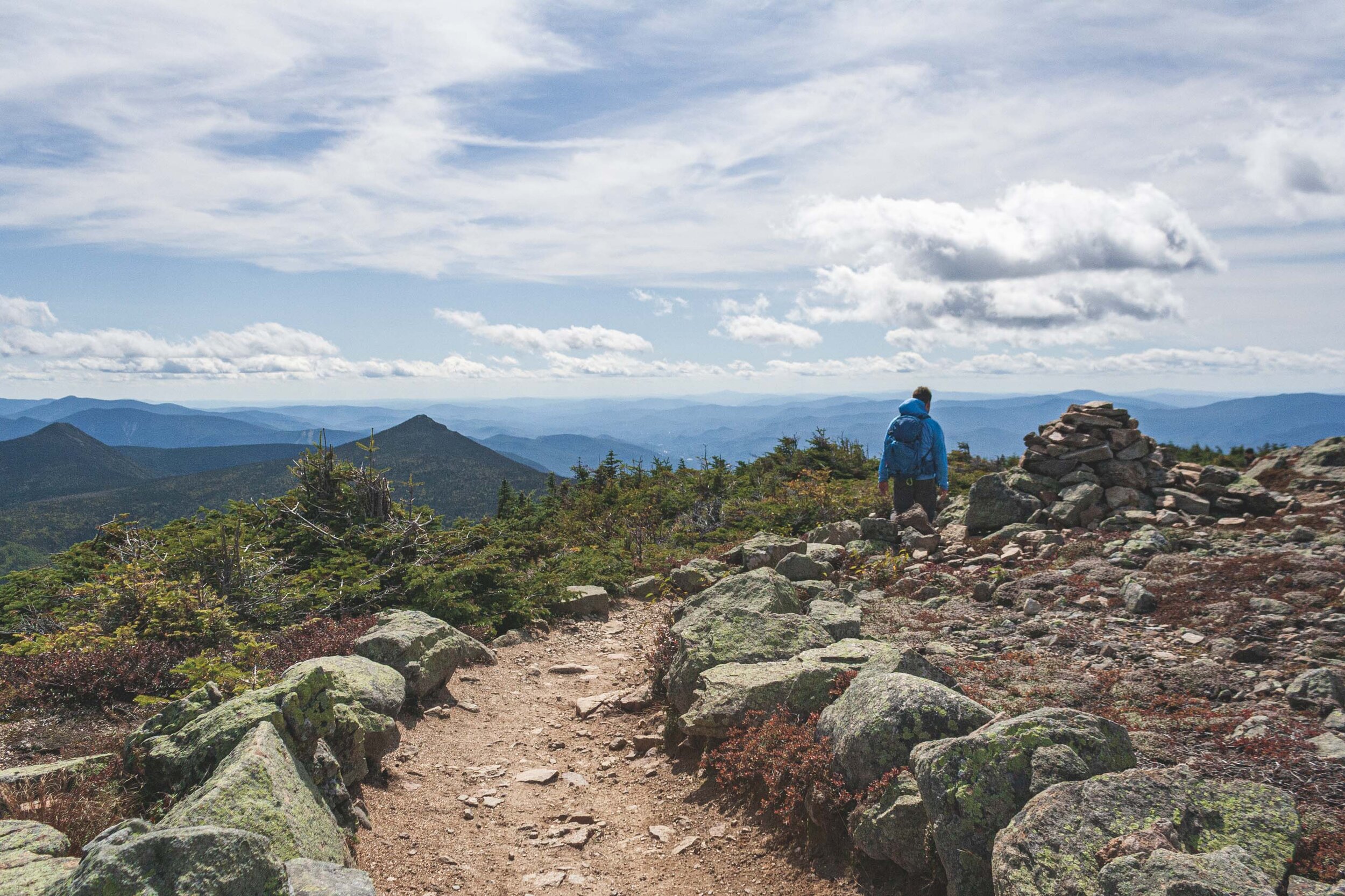
Everyone wants a selfie with the mountains and the view :)

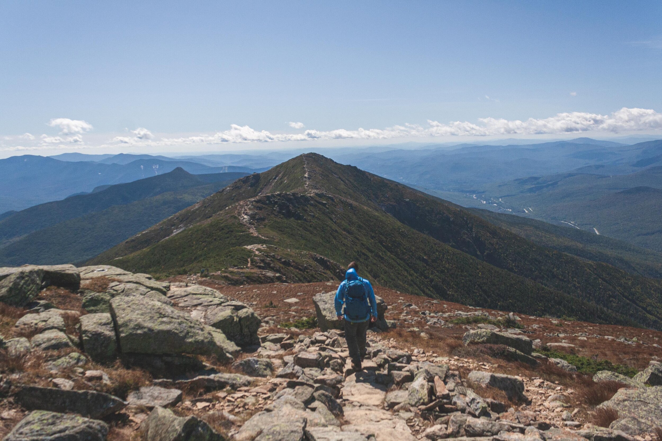
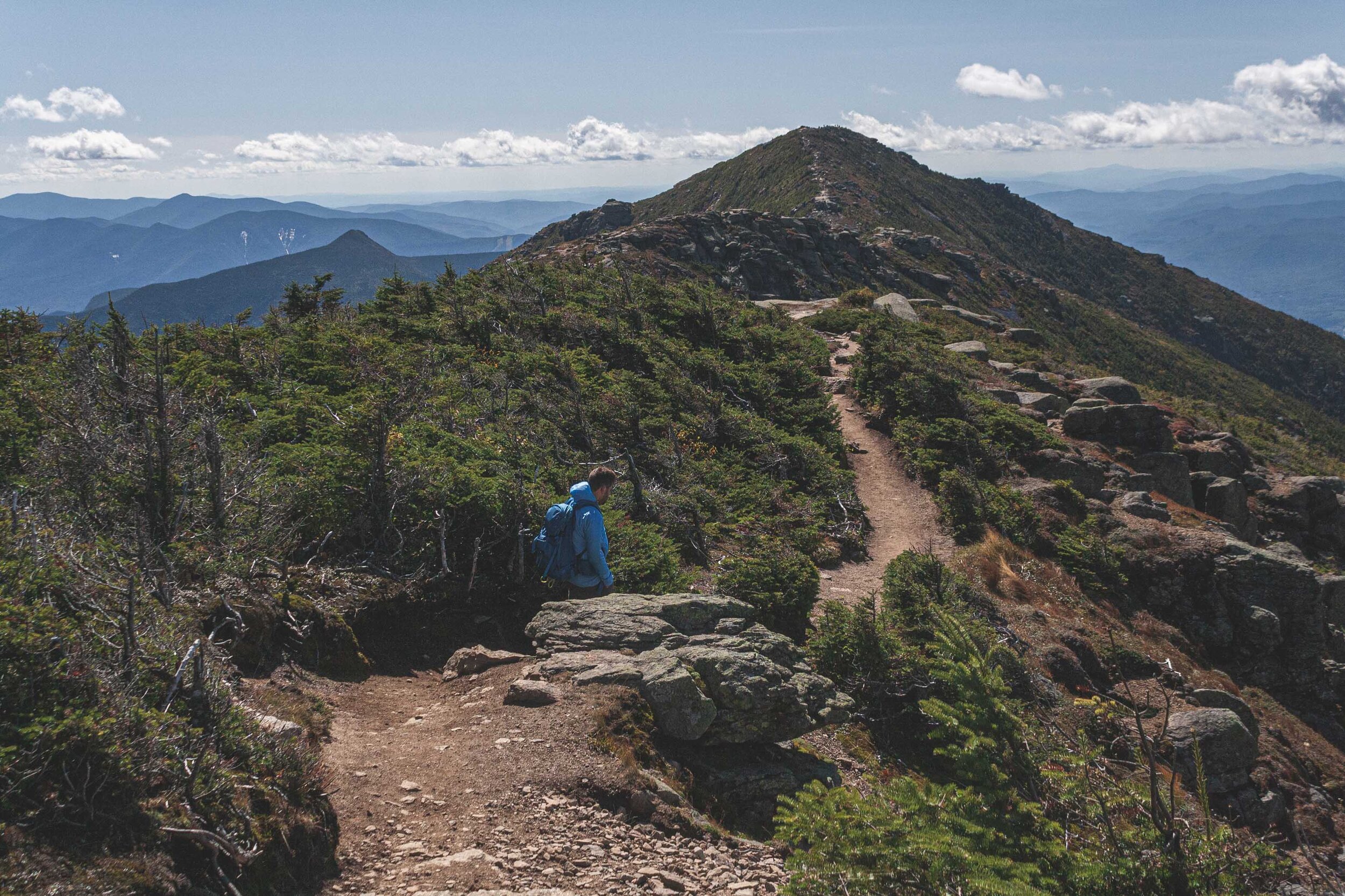
You are constantly hiking up and down and up an down. But knowing that you will eventually get to descend might be the biggest driver to keep moving, well, that and the constant views of course. We came for the view though and we got the views we wanted. It’s hard to not constantly stand and look at the views and and the ridge. Eventually you have to get down too!

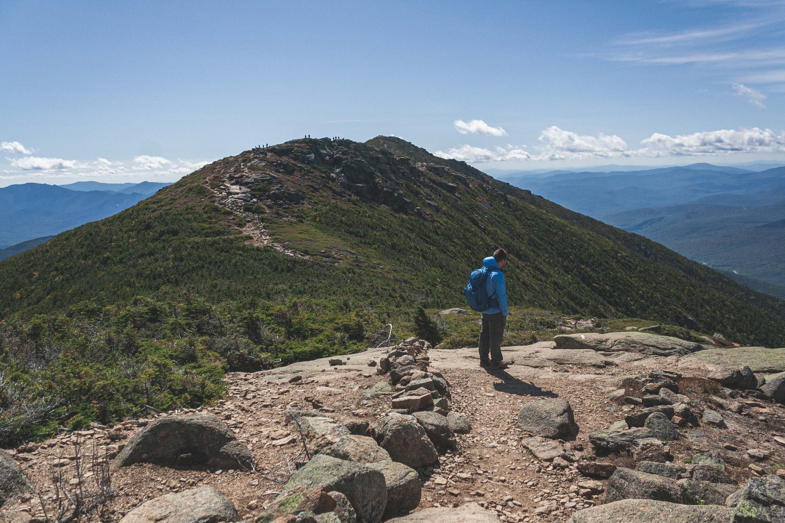
After a couple of hours we had finally conquered the last peak and started the long way home, or well down. Along the ridge line it’s windy of course, windy enough to stunt the growth of the trees. We are in the alpine zone, so eventually as you hike up no trees are able to establish.

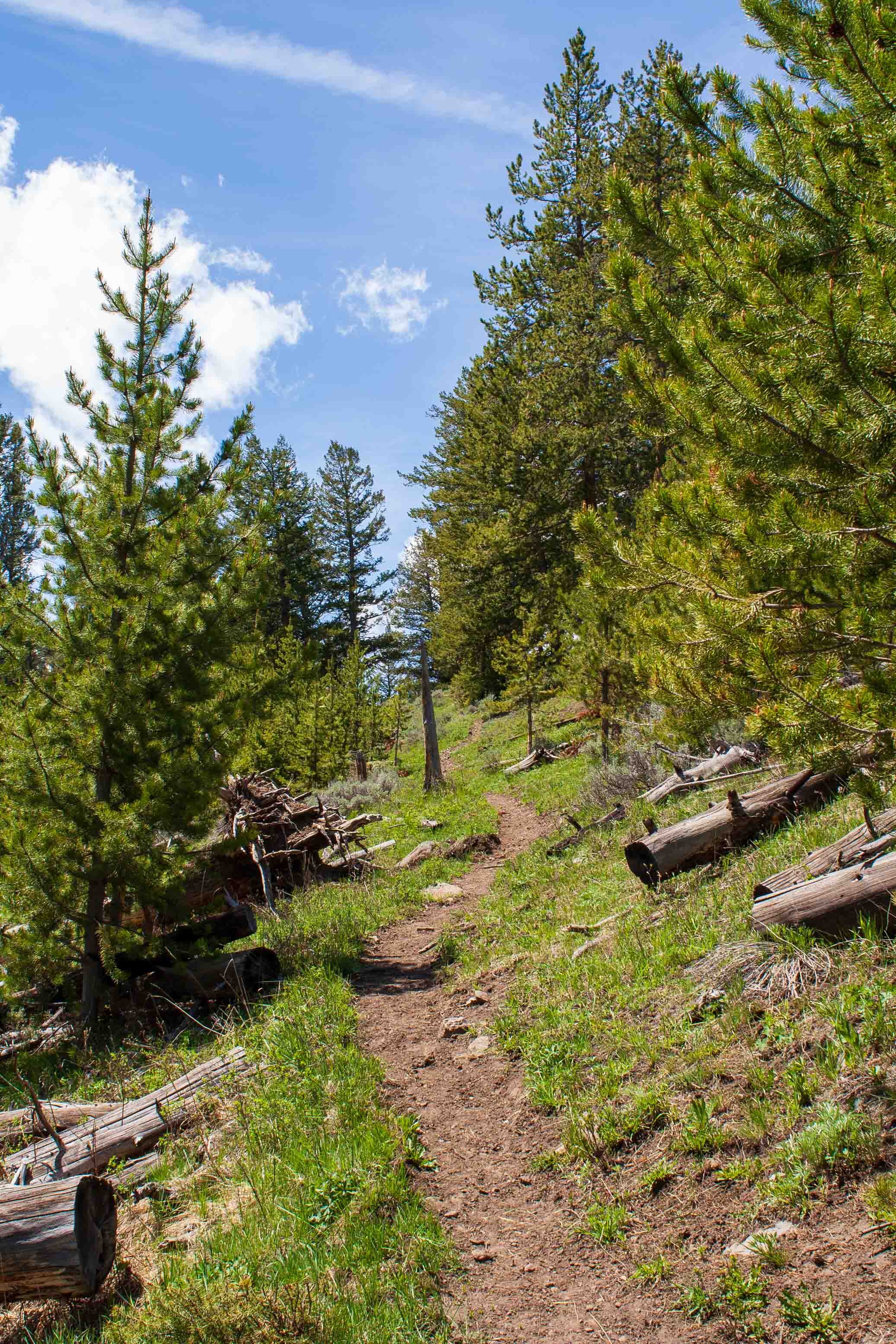
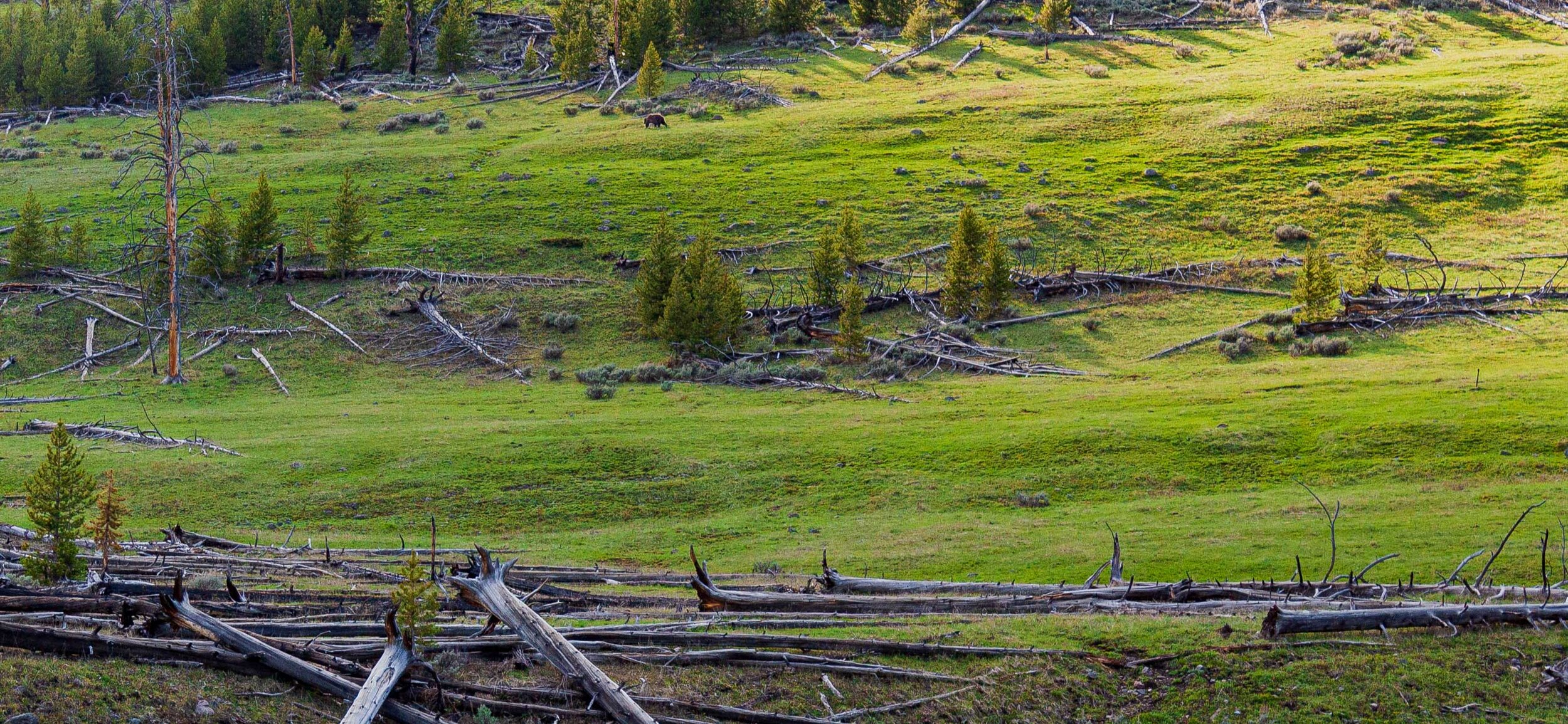
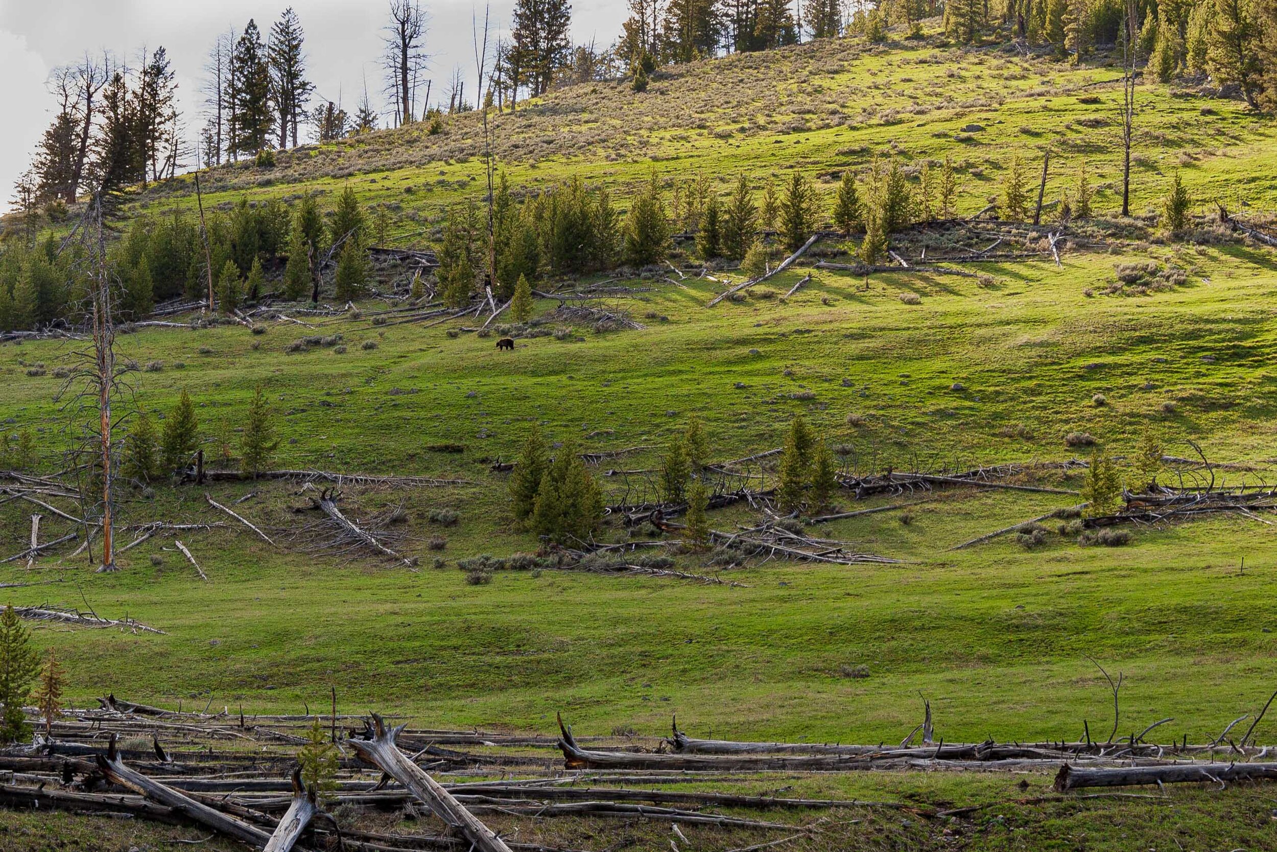
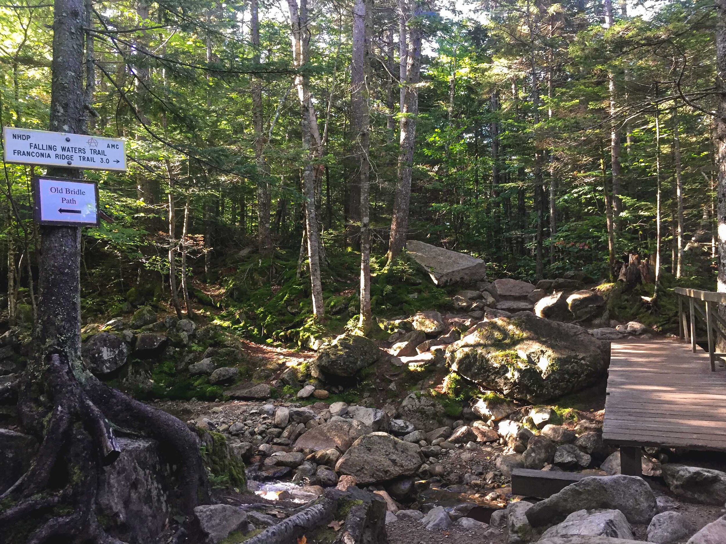
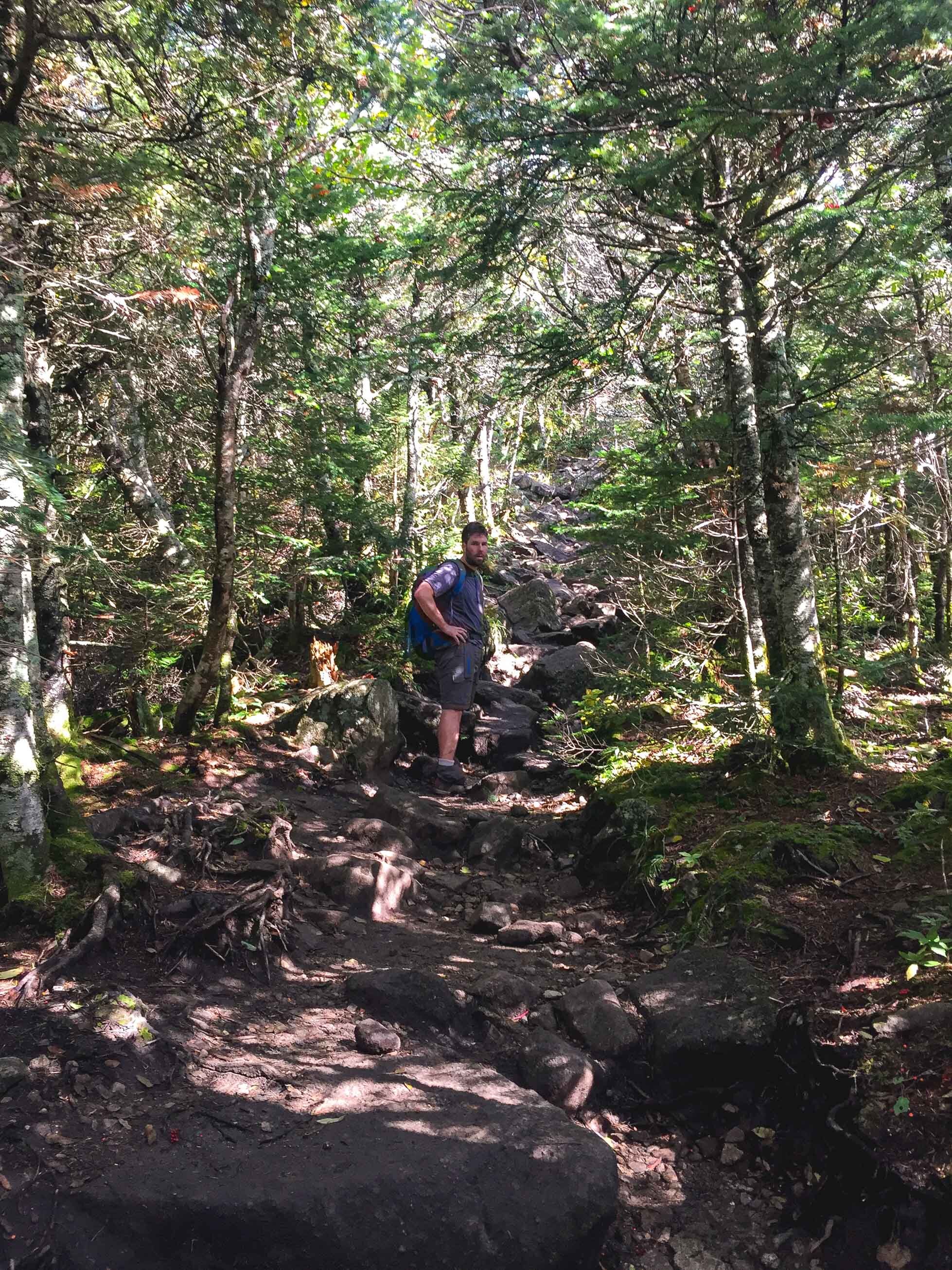
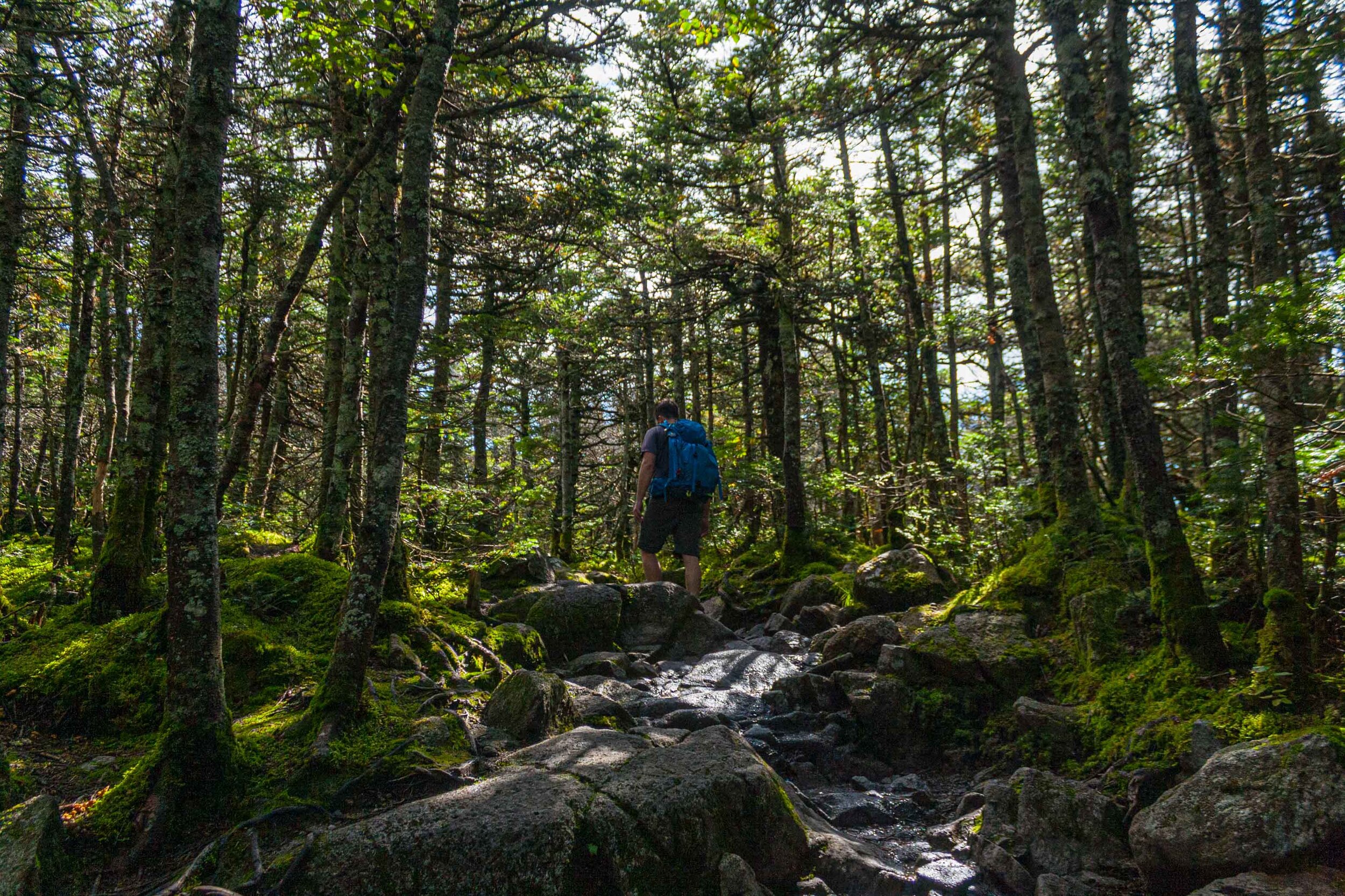
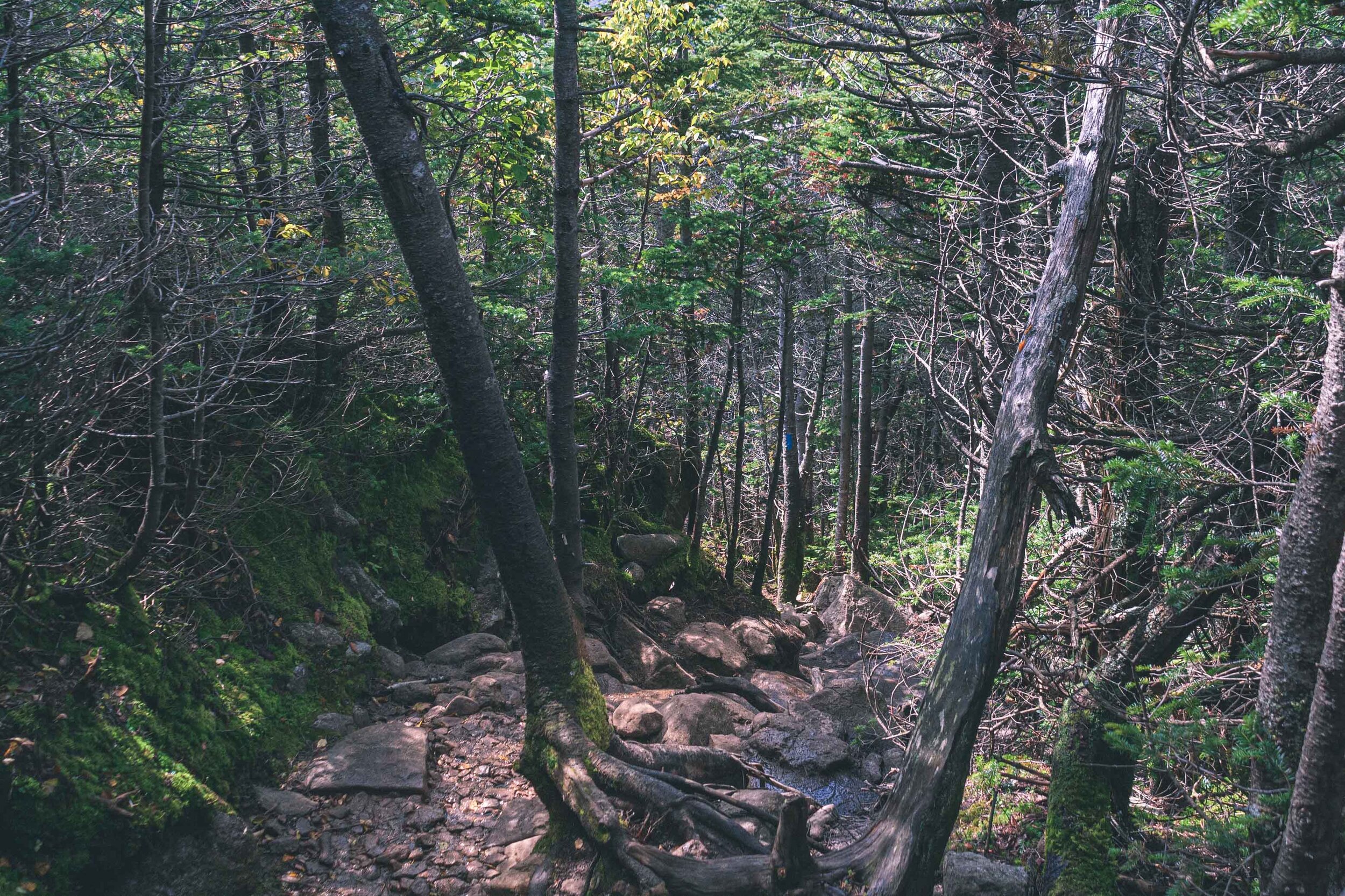
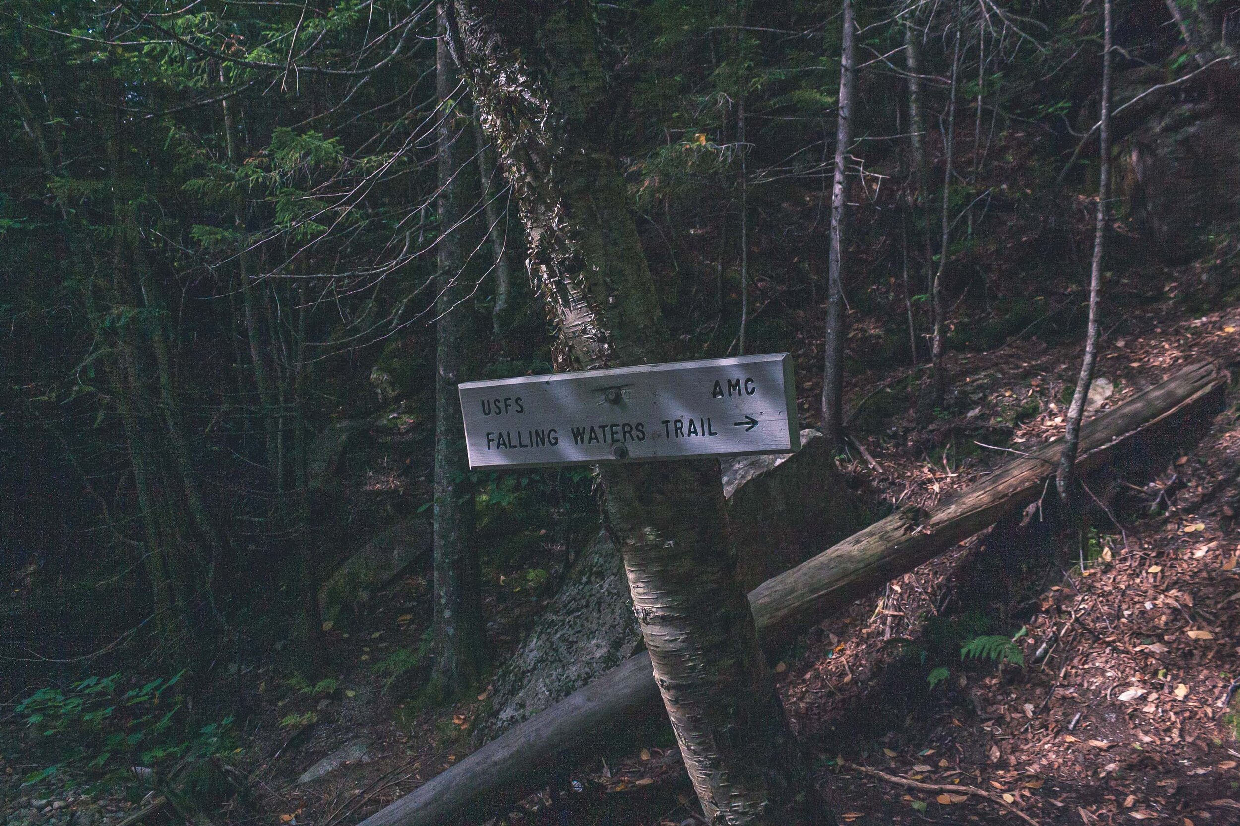
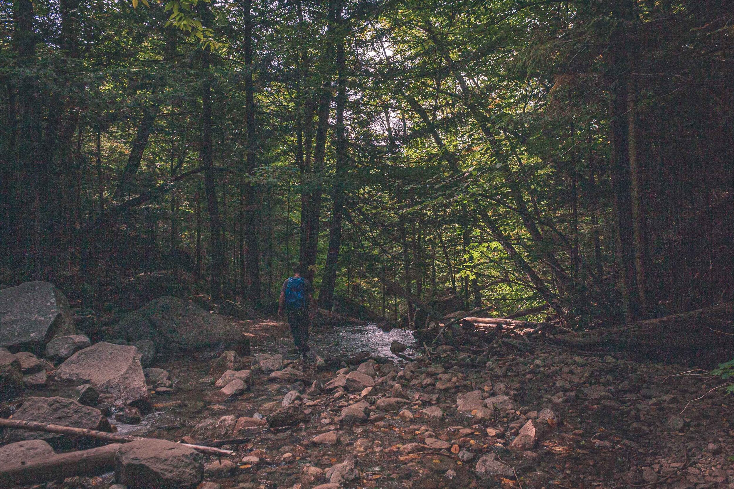
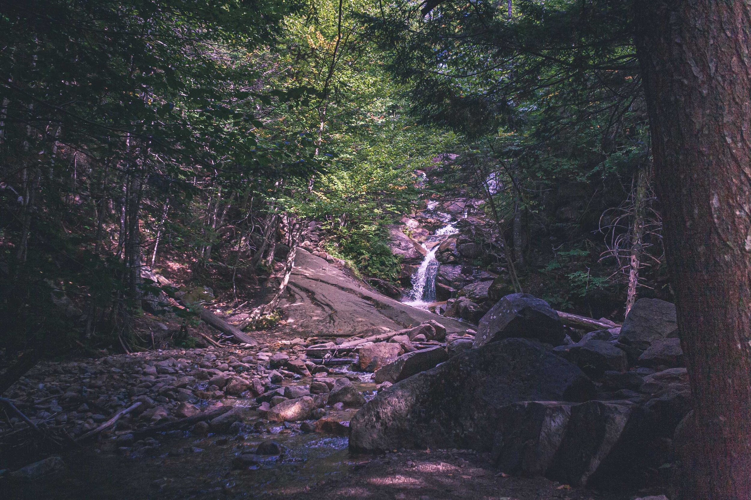
We walked and walked, and walked. The trees got taller and taller until we were out of the alpine zone and found ourselves in the forest, the forest of many waterfalls. I guess there is a reason why this part of the trail is named Falling Waters Trail. We crossed, creeks, and stumbled through waterfalls, just like the hike up Algonquin Peak. I always feel bad hiking like this, the trail looks as if it’s been eroded by everyone hiking. But I am sure this is due to the fact that the geology is like this here on the east coast.

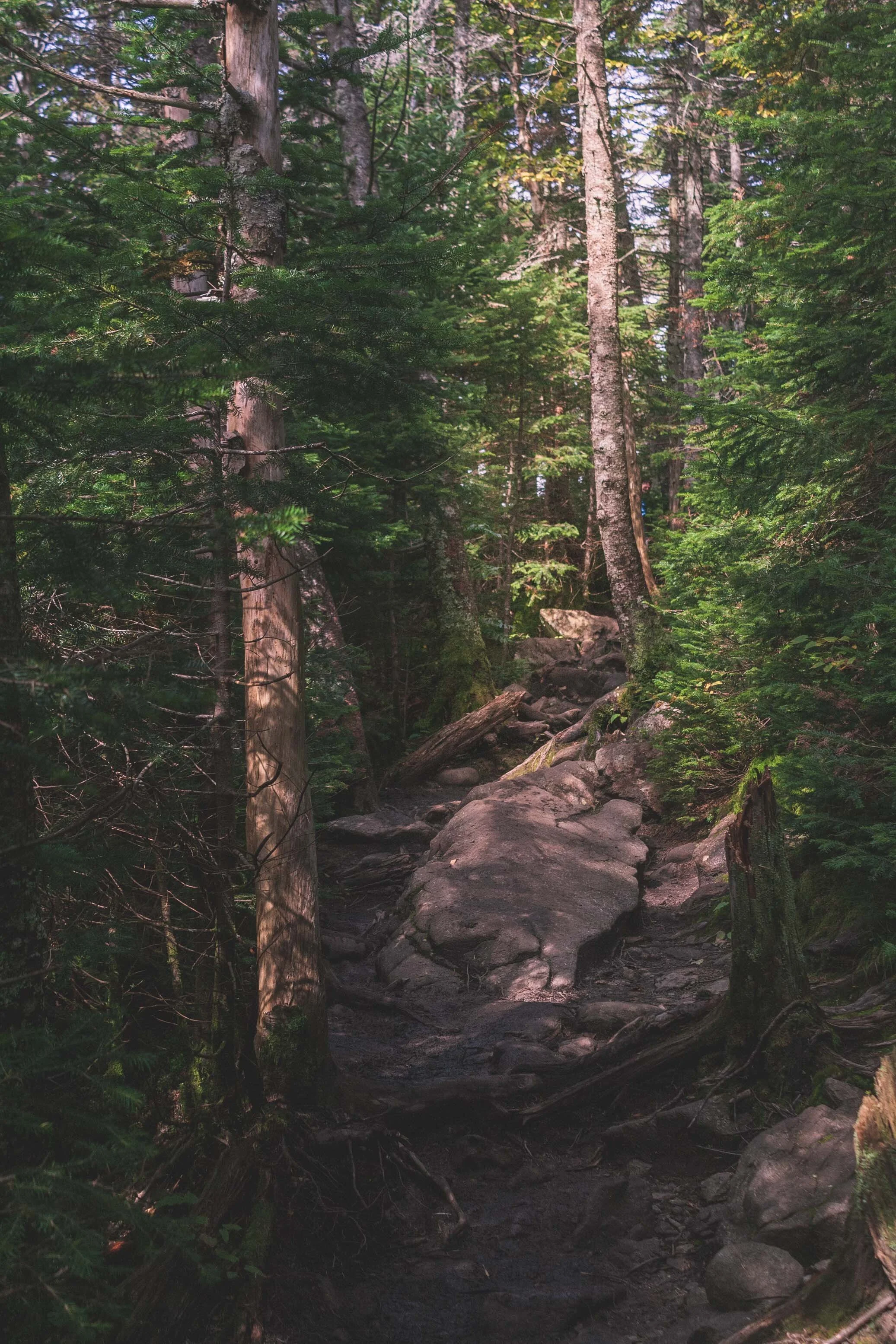
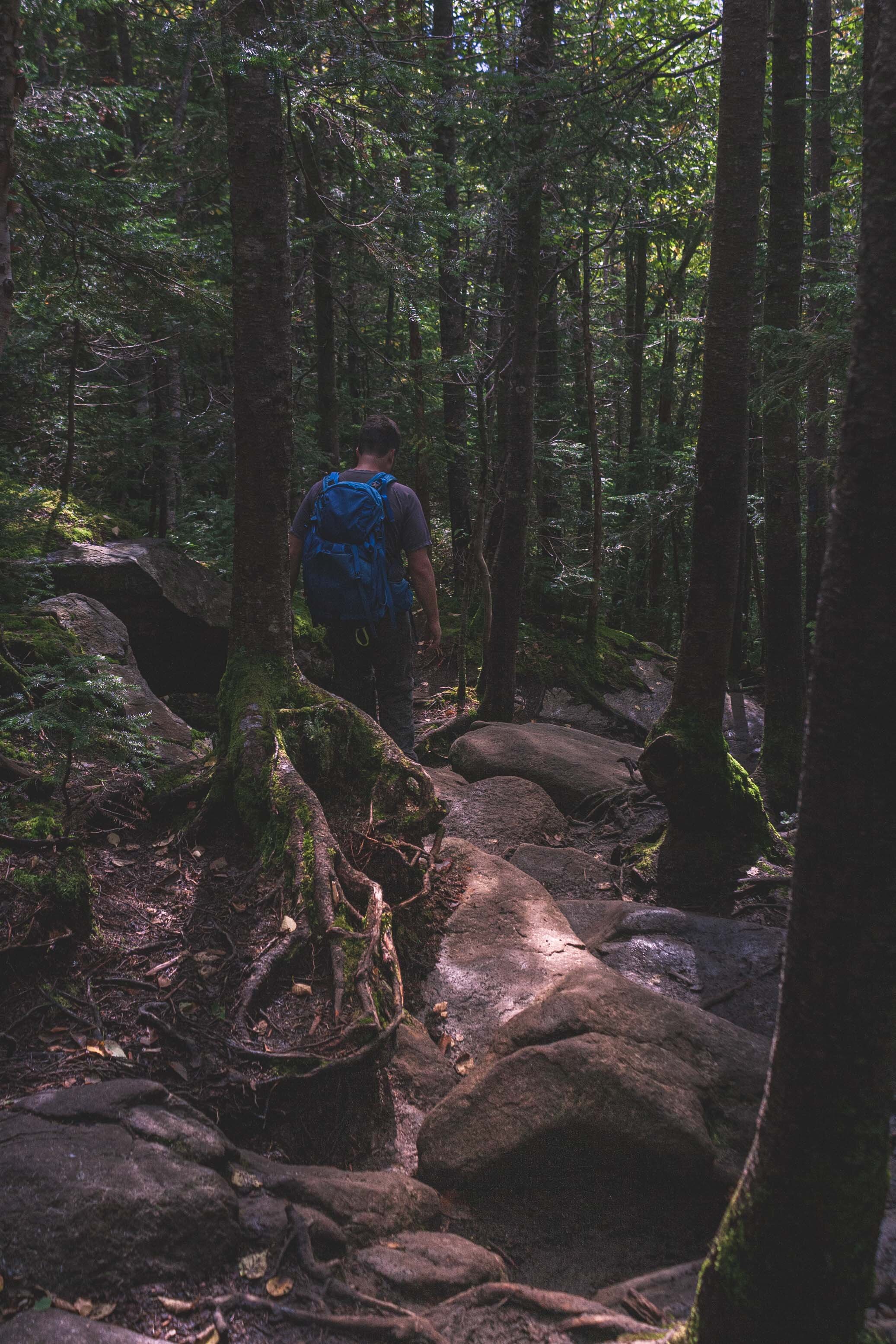
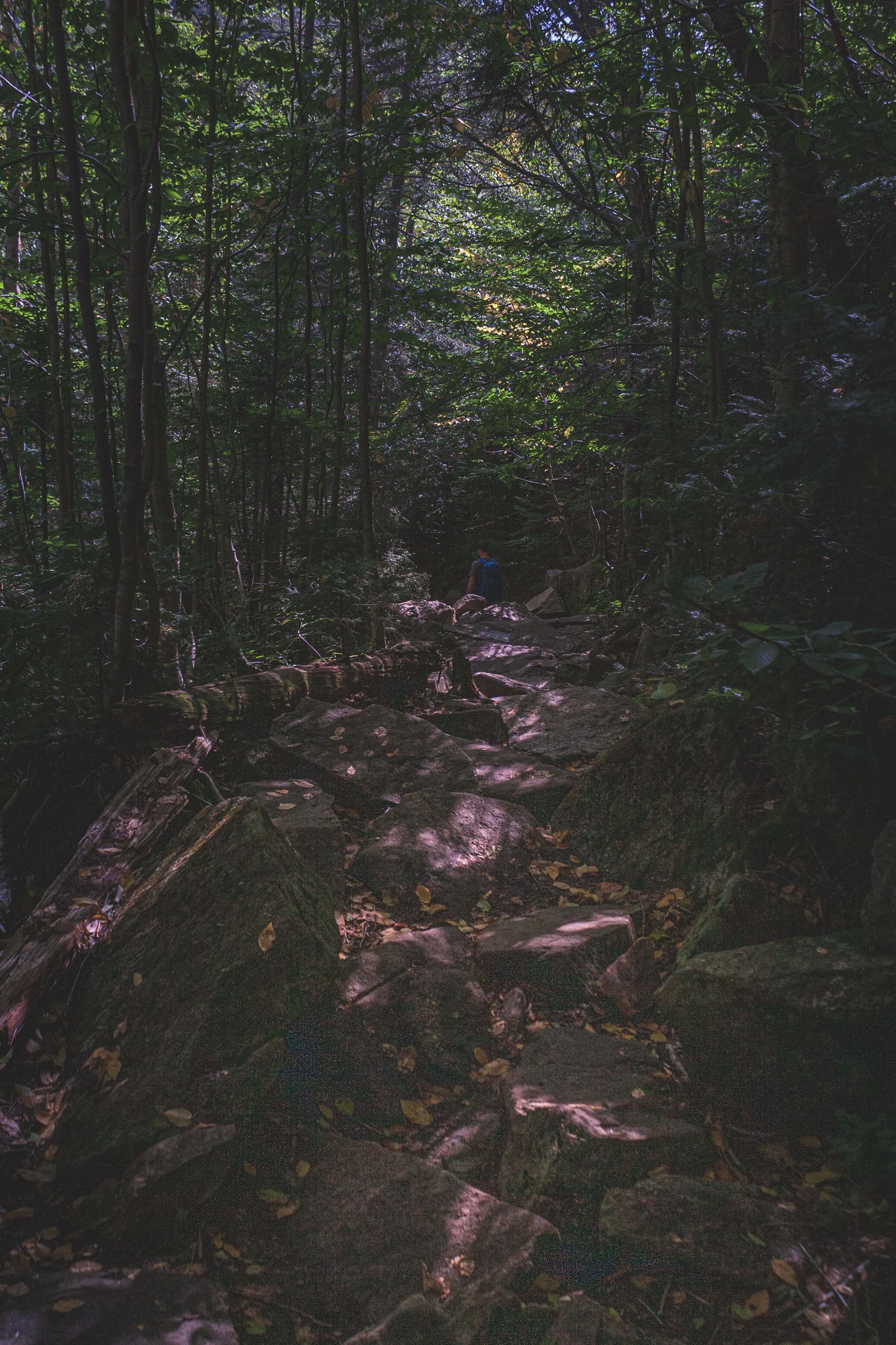
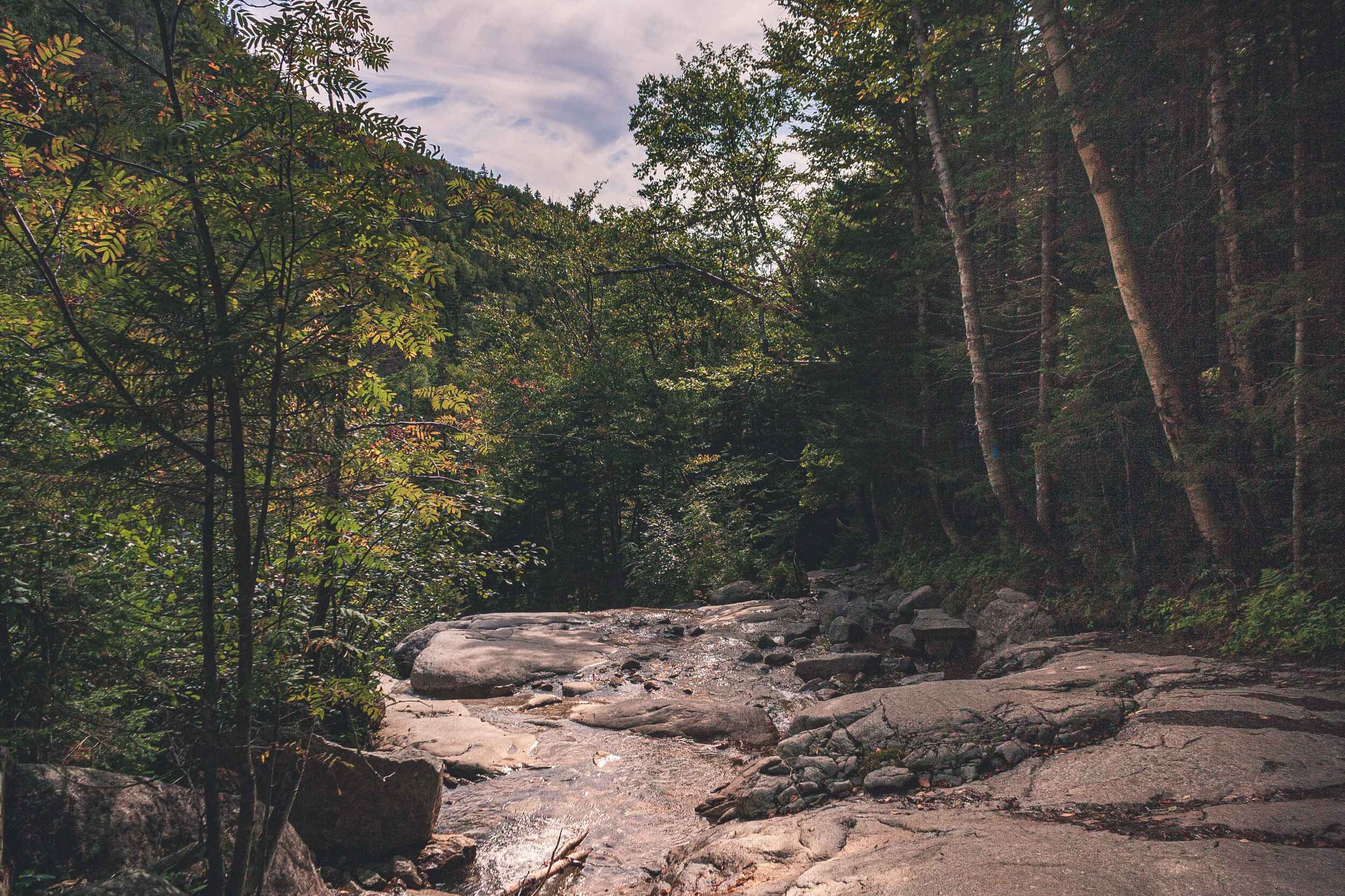
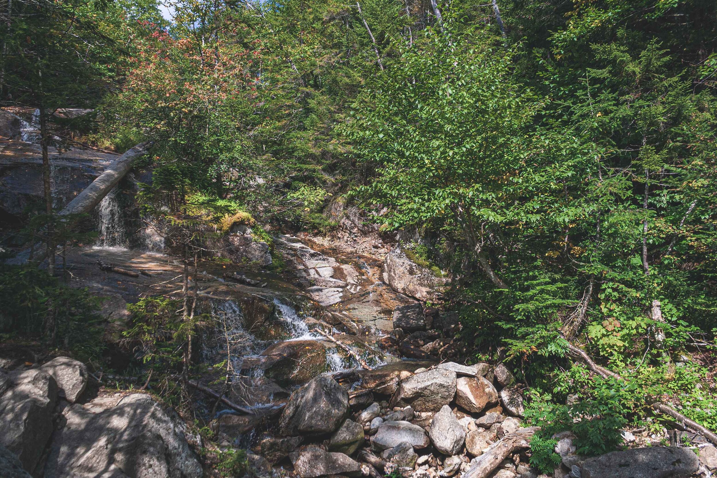
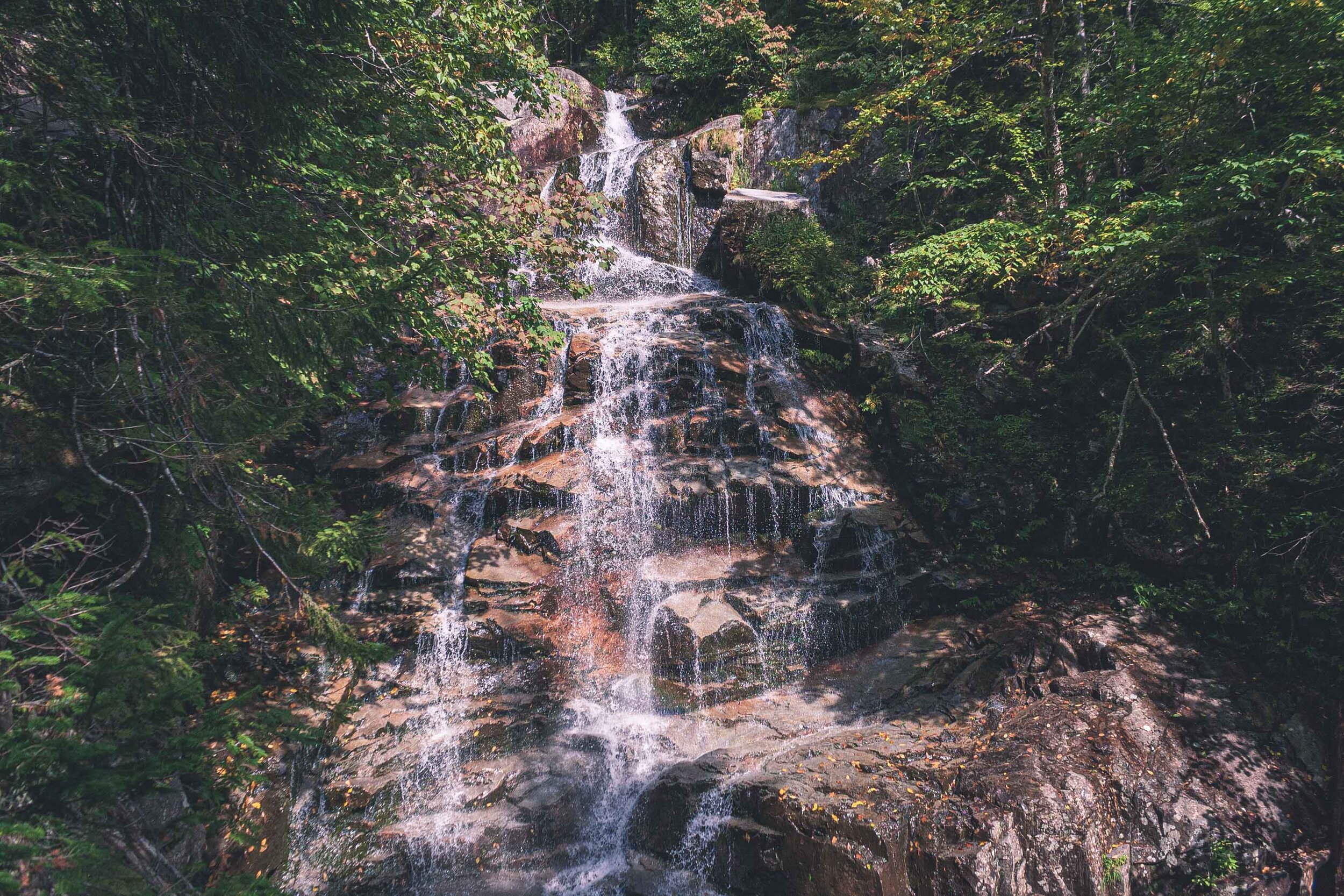
Per usual the legs were already filled with lactic acid and we were both struggling to keep the energy level up. It is very strenuous to constantly hike on boulders. It felt like an eternity, and as with other long hikes we do there is always this worry that darkness will hit before we are done. Halfway down we met two hikers going up. A little late maybe, and they were hiking in flip flops. Or rather, one of them were carrying a pair of broken flip flops and was hiking barefoot. Sometimes I wonder how people make decisions like that, to hike up a mountain in flip flops? We continued down and I guess the waterfalls saved us from getting too bored along the way.

It took about 5-6 hours to finish this hike, so not as long time we took to do Algonquin Peak. But we were so tired afterwards. Another hike that definitely kicked our butts. We were so lucky that the weather cooperated with us.

When we Hiked through Lamar Valley - Summertime in Yellowstone National Park

Adventure Tuesday

Adventures in Yellowstone

May 25-27th 2014

We had just managed to snag the last available campsite outside Gardiner and went to bed under a clear sky in the Rocky Mountains. The next morning I woke up by a strange noise, something was eating outside the tent, and it brought back memories from a different morning in Alaska when the same thing had happened. As I opened up the tent I was greeted by a bunch of elk. The following years I learned that this area, just up the hill from Gardiner is a prime spot for elk. Other than the noise from the elk it was very quiet around camp. People had been up partying into the wee hours last night, but we had major plans this morning and went to bed early. I was as excited I could possible be as I glanced over Yellowstone National Park while I had my coffee. I could not believe that I finally would get to hike in the mountains in Yellowstone. We were going to have a long day ahead of us, but first we had to get to the park and reserve a backcountry camping spot! These are first come first serve so we didn’t want to risk loosing our plan.

Up until this trip I’d only seen Yellowstone in a blanket of deep snow so I was stoked to finally get to see this beauty dressed in green. It was late May and even though spring is on the way in many places in the US at this point it can be slower here because of the high elevation.

Karta - Lamar Valley.jpg

We’d been checking a couple of different short routes we could do, but after having to remove our top choice due to a late spring and too much water (that hike had a stream crossing without a bridge) we dialed in on a fairly decent hike into the Lamar Valley. If you’ve followed my blog for a while you have probably seen Lamar Valley, a huge valley blanketed in snow in the wintertime where you can spot wolf and bison. There are plenty of bison in this area in the summertime too, something we would soon find out.

I usually don’t take as many pictures during the actual hike, it would take forever to reach our main destination if I did. And especially when we are hiking in a new area you never quite know how long it will take. Sometimes I wish we had more time to stop and take more photos. This time i managed to take a couple of photos right before our bison incident…

W basically grew up with Yellowstone in his backyard and both of us had been living in Alaska for a few years when we embarked on this hike. In the deep forests of Montana and Alaska you are taught to make noise and spaek loudly, so that you do not accidentally surprise a bear. So we did what we have always done, talking loudly, clapping our hands until we rounded this tiny little hill and were greeted by a loud humpf. Before we knew it a huge bison that had been laying down, resting, turned his head towards us started to get up. We slowly walked away but somehow we were now inside a whole herd of bison. I don’t know how we managed to get into this situation. But, to clarify, we felt as if we were inside a herd of bison, but herds a very spread out. We were definitely too close to be comfortable. I closed my eyes and wished that I could stick my head in the ground. In the same manner as we somehow had gotten us into this situation we managed to get out of it. I always view bison as somewhat stupid creatures, that in combination with the fact that they are very large makes them extremely dangerous.

We continued our hike, walking through the valley and previously burned forest. We met a couple of other hikers and they had just been to the campspot we were going to. They told us, just like the previous group had told them, that a large grizzly walks by the camp up on the hill at about 5pm every night.

IMG_8205-May 26, 2014-2.jpg

We continued walking, through brush and over logs. We took a lunchbreak in the shadow of an old Lodgepole Pine. We checked the map again to see how much farther we had to walk. We checked the GPS and realized we had already passed the campsite and could not understand how that was even possible. We started walking back, probably for a good 30 minutes until both of us were doubting what we had seen on the GPS. It turned out that there was an older campsite on the map in the GPS. We realized that once we took up the paper map and crossed checked. So we started walking back, into the valley again, walking the same path for the third time this day. During this time we also started seeing some lone bisons along the trail. Some of them were hanging out in the forest. I had up until now only viewed bison as creatures that love hanging out in large open spaces, but apparently that is not true. So now we had to be on our toes about bison in the forest too. We crossed small creeks and stepped over large boulders and logs. In some areas the logs looked like pickup sticks, very large pickup sticks.

“A few minutes later W whispers
-There it is, there’s the bear “

We finally arrived and were sitting down at our home for the night. It was beautiful. The mountains in front of us and two hillsides on either side of us. We were also right next to the Lamar River which was raging at this time. i looked at my watch, it was approaching 5pm. I told W that it would have been nice to know on what hillside the other campers saw the bear, on the hillside by us or on the other side of Lamar River. Not more than a few minutes later W whispers - There it is, there’s the bear.

I immediately flew up with one hand on the bear spray and whispering in a frantic tone WHERE WHERE?? But then I realized that the bear actually was pretty far away from us. And she, or he, must have known about our presence. The bear continued along the hillside and you could see that it was on a mission. It payed zero interest to us, as it continued forward before it disappeared behind a hill.

After the bear viewing it was finally time for some food. W, as always, cooks the food and I took care of the fire, and water situation. If there is one good thing that I learned during my time studying in Alaska it is to find springs. Spring water you don’t need to filter, it is mostly clean and ice cold. And since we were on a hillside I quickly found some very active springs. We were watching the mountains and talking about this and that before we started to pack up the food and realized we’d forgotten the rope.When you are backcountry camping in Yellowstone (and many other National Parks in the US, especially in the Rocky Mountains) you have to hang your food up, to prevent bears from getting it. We decided to use one of the tent strings that was strong enough for the food. But we had wanted to hang our packs and clothes up too. Instead we placed them by the food storage area. We changed clothes and put the clothes we used for cooking into the backpacks and then we also put a plastic bag on top of the backapacks. We’d already got our tent set up far away from the food storage area.

Before we knew it we were watching the sunset in the mountains and soon after we went to bed. But what a night. We kept hearing noises all night, it was hard to tease apart if it was the river we heard, the trees or worse a bison or a bear walking around. At one point we herd a loud thump. I layed dead still and whispered did you hear that. W was also wide awake, and he had heard it too. W was convinced that a bear had gotten to our food, I kept thinking that a bison was walking around our campsite and was heading towards our tent. And that is how most of the night continued. At some point we must have fallen asleep completely though because in the morning we woke up by male elk calling for a couple of females. After some well needed coffee and breakfast we were finally ready to hit the trail again.

We packed up and started the hike back. Both of us were already feeling a bit stressed ove the first part of the hike which included all these large herds of bison. We met some new campers who were heading out to the campsite we just left. We told them about the bear and also asked them about the bison. They told us there were many bison covering the whole trail and made it hard to pass. Great. So once we approached that area we started to walk up up and up the hill. In this way we would be able to see where the bison were and maneuver in that way. We trecked through the sage brush that tore our legs up, cause we were of course wearing shorts. Once up the hill we didn’t see a single bison down below.

IMG_8378-May 27, 2014.jpg

Do you want to read more posts about Yellowstone National Park? Click the link below:

Dispersed Camping in the Catskills - New York

Adventure Tuesday

North to the Catskills

I’ve been MIA again, for a while. We do things, quite often, but with life i don’t feel that I have enough time to share it. Back in May, when it was raining every other day and I also got soaked each and every one of those days we decided to go north. Nowadays I take less and less photos, and if I do it is with my Iphone, it is just too much of a hassle to bring the big camera. Maybe I need to invest in a a smaller, mirror-less camera. Either way, we finally found ourselves driving north under dark clouds and rain, but the weather forecast had promised us some sun this weekend. We were heading towards the Catskills, a name that actually comes from the dutch, go figure, and mean cat stream. The Catskills are a part of the Appalachian Mountains, and thus the mountain part is the reason we ventured out in the first place.

At first we were thinking of maybe finding a cheap airbnb in the area. but it seems as if cheap airbnbs are in the past, and today many, if not all are an expensive endeavor. So instead we went camping. In the US there are a few tricks that can give you free camping. Many National Forests and BLM land allow you to camp for free, maybe you have heard of the term dispersed camping. You are allowed to camp at certain locations if you are 150 feet away from a stream, road, established campground (in NY state see more here: Primitive Camping). Of course in this way you have no amenities. Forget about that vending machine that stares at you when you want to use the restroom at 1 am, and yes forget about the restroom too. Dispersed camping is not for the faint of heart, and for you to have the best experience at this you should be prepared on being miserable, well, if you are not used to camping in this way that is.

ONE THING YOU NEED TO KNOW BEFORE GOING IS THAT YOU ARE RESPONSIBLE FOR EVERYTHING YOU DO AT THESE LOCATIONS. PACK IN PACK OUT, THAT INCLUDES TOILET PAPER. HUMAN WASTE NEEDS TO BE BURIED 6-8 INCHES DEEP AT LEAST 150 FEET FROM WATER (NY STATE). DO NOT START FIRES UNLESS THERE IS AN ESTABLISHED FIRE PIT. DO NOT USE LIVE TREES OR BUSHES TO START A FIRE, DO NOT REMOVE ROCKS FOSSILS etc FROM THE AREA.

IF YOU DON’T WANT TO FOLLOW THESE RULES, DISPERSED CAMPING IS NOT FOR YOU.

You can always read more about dispersed camping and where you can, and can’t camp on your local National Forest or BLM webpage. There are also wilderness areas, which is where we did our dispersed camping. If you want to read more about all the public lands the US has to offer and what the difference is between all of them you can read more here. It could have been an awesome weekend, if it wasn’t for the fact that I got such a bad stomach ache during the night that we had to call it off and go home already on Saturday, but not before we did a tiny bit of hiking.

As the rain slowly tapered off we realized the rain had been moving towards us, which is a good thing, and we entered a very wet Catskills that had been dumped by large amounts of rain earlier. I have to admit, the east coast is growing on us. I mean look at these photos. The small towns we drive through, and the medieval look to it was fantastic. I had been browsing a Facebook group about camping suggestions in the Catskills, and found a couple of good options, free options in the area we wanted to be. Of course, since it had been raining we were alone. At first we started walking on the big open field, and realized it was all soggy, totally soaked. We can’t camp here. I turned towards the other side and the forest. Usually in areas where dispersed camping is allowed, a campsite has already been established, and a path usually takes you there. This was true in this area too. Once we walked towards the forest and the dry understory, we followed a path to a perfect flat area.

There is something about arriving at your campsite, grab a drink and just exhale. This is how we relax now, go somewhere where we can be alone. New York City and Manhattan is growing on us, but it’s not like Madison, or even close to Fairbanks. We love smaller towns, which sometimes makes us wonder, what are we really doing here. But, we are not going to be here indefinitely, so we are trying to soak up this adventure while we are at it. When we go camping I usually set up the tent and W does the cooking. In the morning I usually make coffee, because I get up early, and W makes breakfast while I take down the tent. It works very well, and I think it is good to have set chores like that. It is a lot easier to get a smooth set up if each one knows what they can do. We had a great evening, even though it got dark pretty fast. We went to bed pretty early, since we have had a really long day, working and then travelling north.

The next morning I woke up early, I had been waking up and falling asleep for quite some time because of pain in my stomach. It wasn’t the food or anything like that. We had a slow morning, for me to decide what I wanted to do. And I decided that we should go home. We packed up the tent, well W did because I was in pain. Had coffee, W had breakfast but I didn’t want any. We did go to the hike we had planned, and walked around in the forest for a bit before driving back towards NYC. Until next time!!

It was still nice to get out into the forest like this, and again so amazing to be in a place with fewer people out and about. The east coast is known for its dense population and so many people out on the trails. But again, we found ourselves almost alone.

Even though this trip got an abrupt ending, I still look forward to exploring more of the Catskills. We just have to make time for it!